Rwanda and the Lake

20170317_171553
Weekly market at Lake Bunyonyi

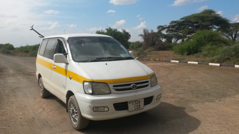
To get to Lake Bunyonyi in the mountainous far southwest corner of Uganda via public transport, I could either take a night bus that arrived in the nearby city of Kabale at 4am (missing seeing the countryside along the way, as well as risking the danger of night busing in East Africa) or take a matatu (minibus) to Mbarara and then catch the next vehicle heading toward Kabale. I chose the latter (despite the additional safety concern of riding a matatu) and hopped on a little before 9am. After waiting for an hour for the car to fill with passengers (typical), the driver pulled around and told everyone to switch into the next matatu because of a mechanical issue. The attendants filled the new car’s tires with air and we were off, only to pull over at a gas station about 15 kilometers outside of Fort Portal with yet another mechanical issue. I was becoming increasingly frustrated, and based on my previous experience with the bus to Fort Portal I decided to catch a ride back to town, bite the bullet and pay for a car and driver to take me directly to Bunyonyi.

20170318_075319-1
Lake Bunyonyi, Uganda

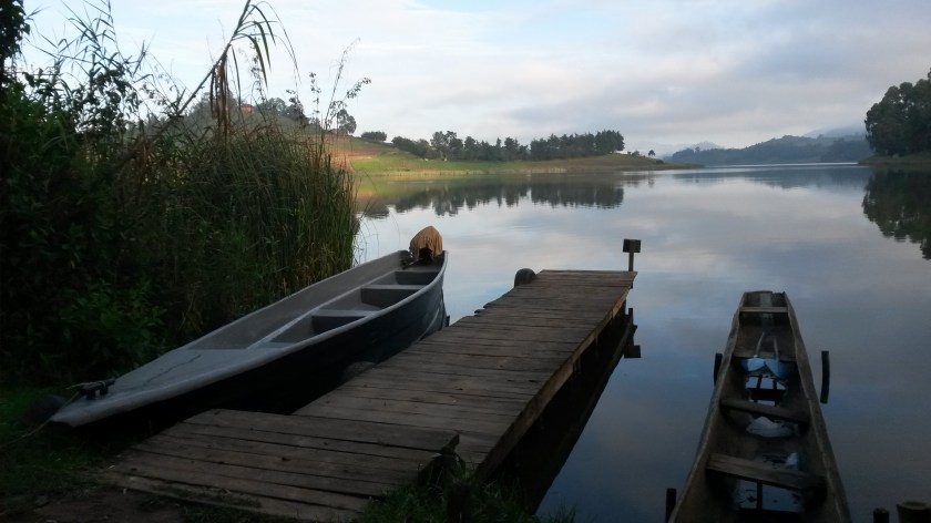
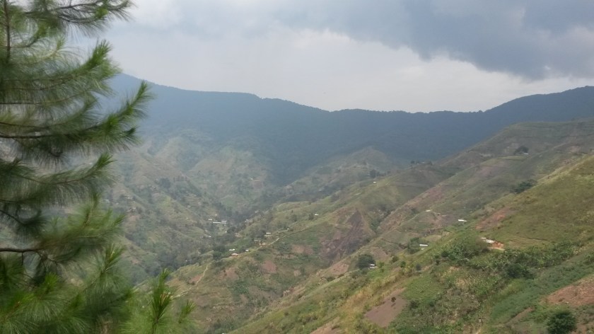
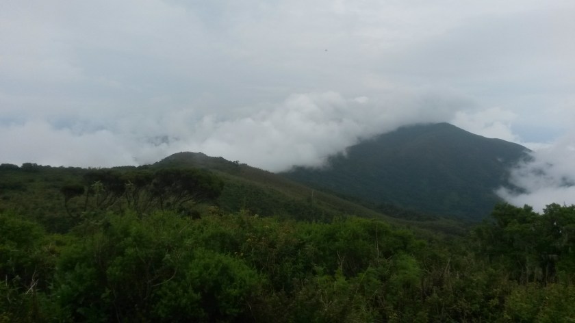
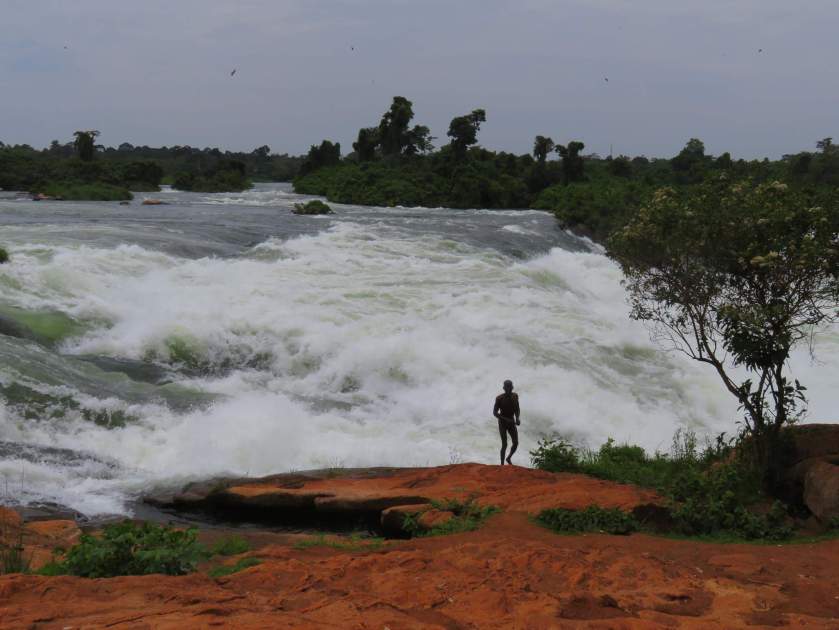
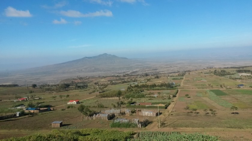
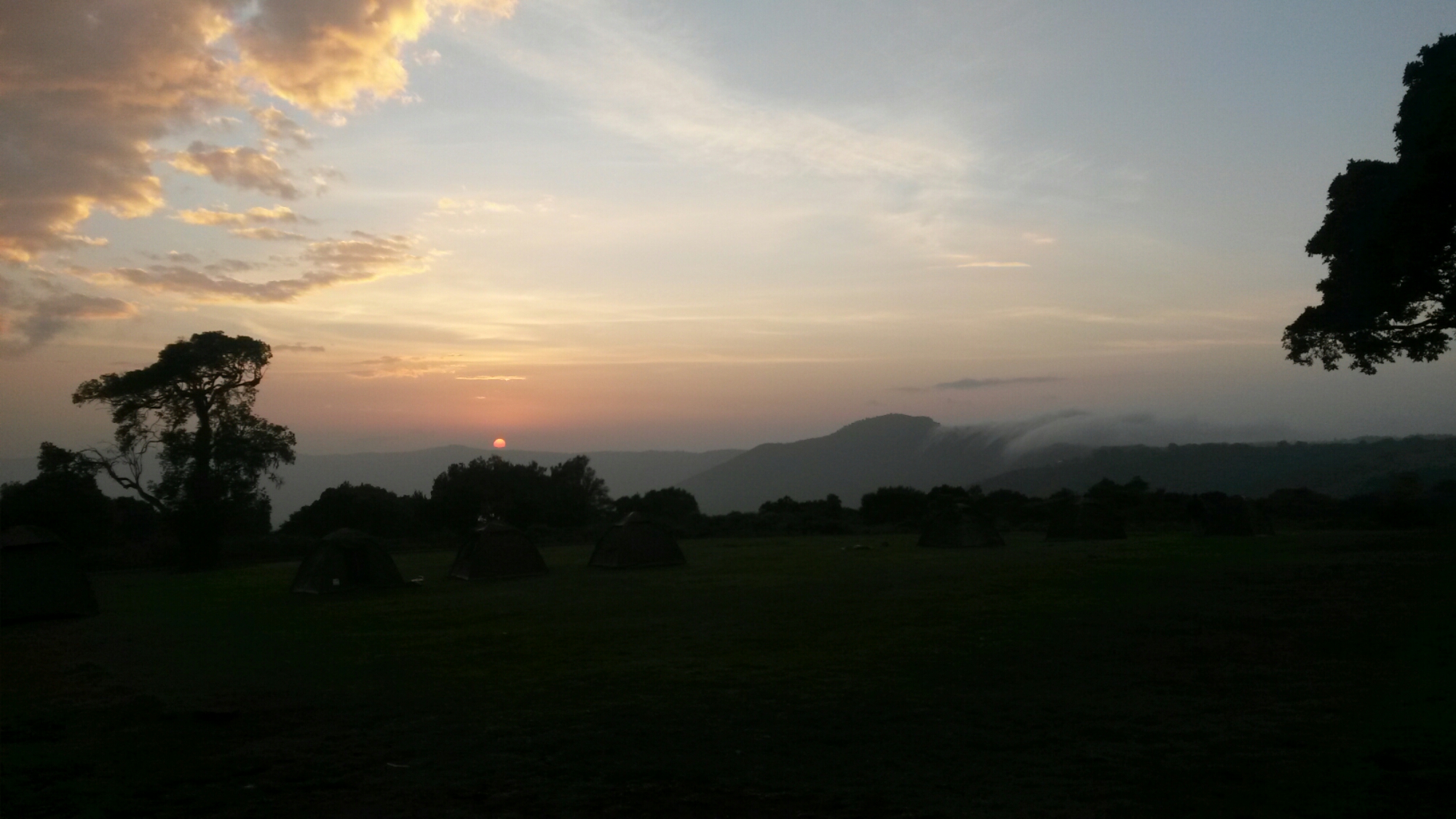
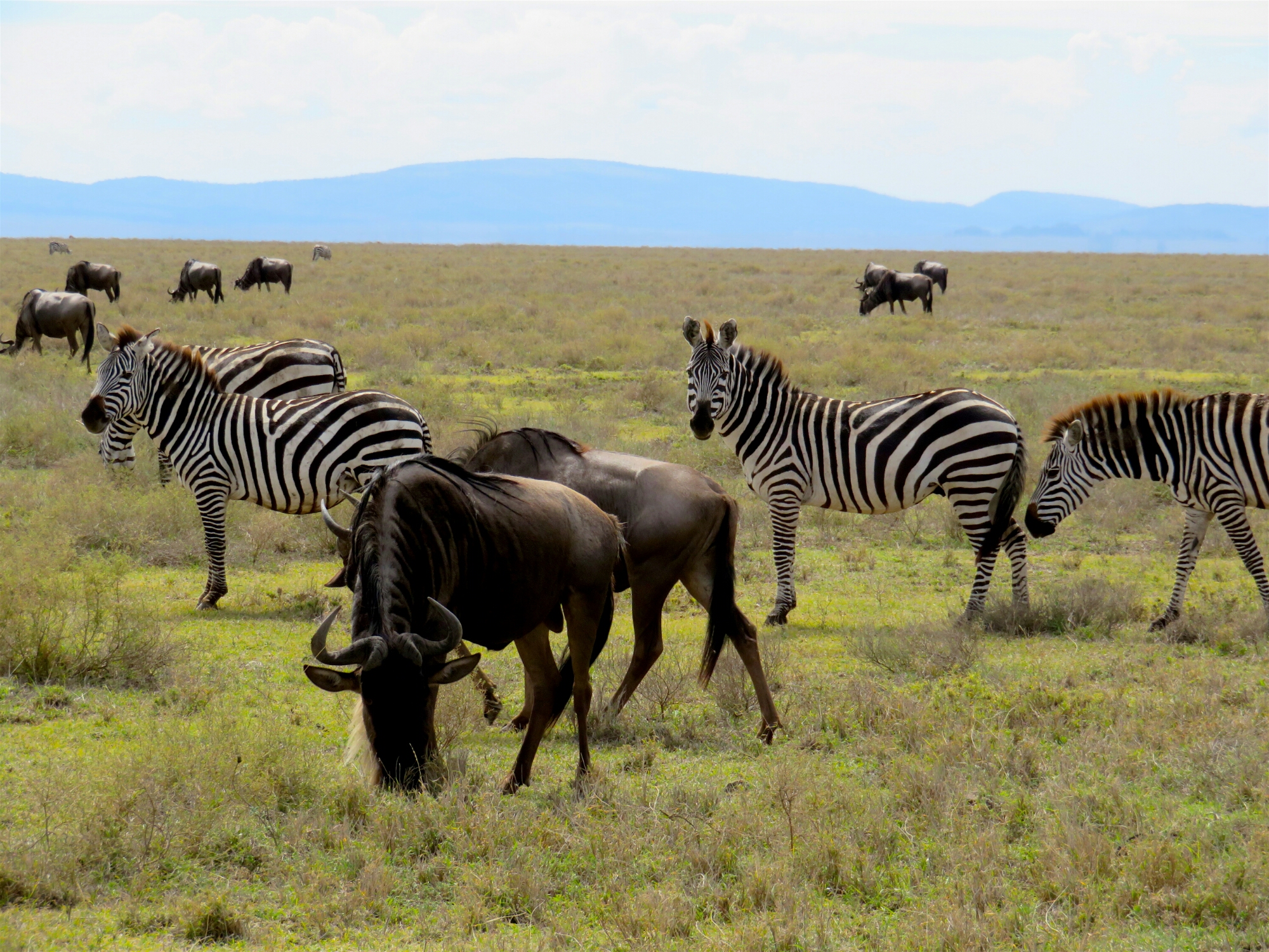
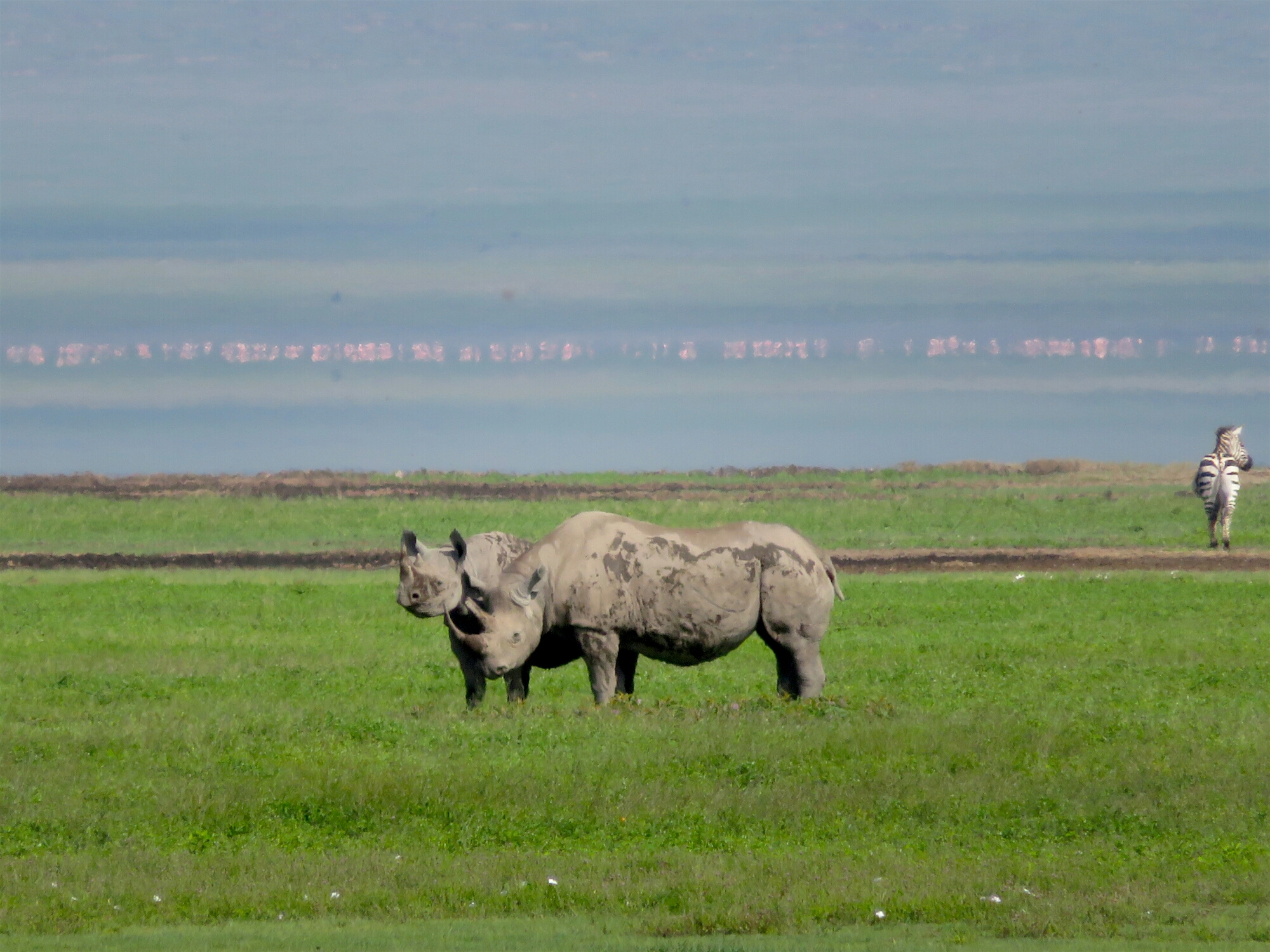
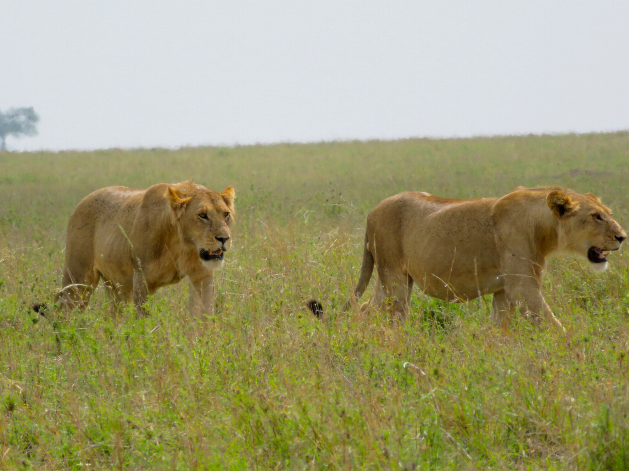
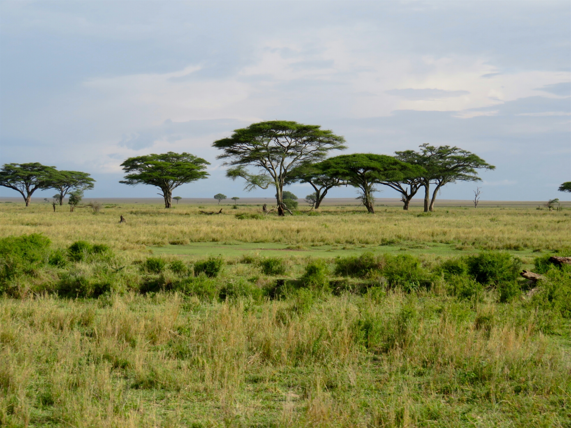
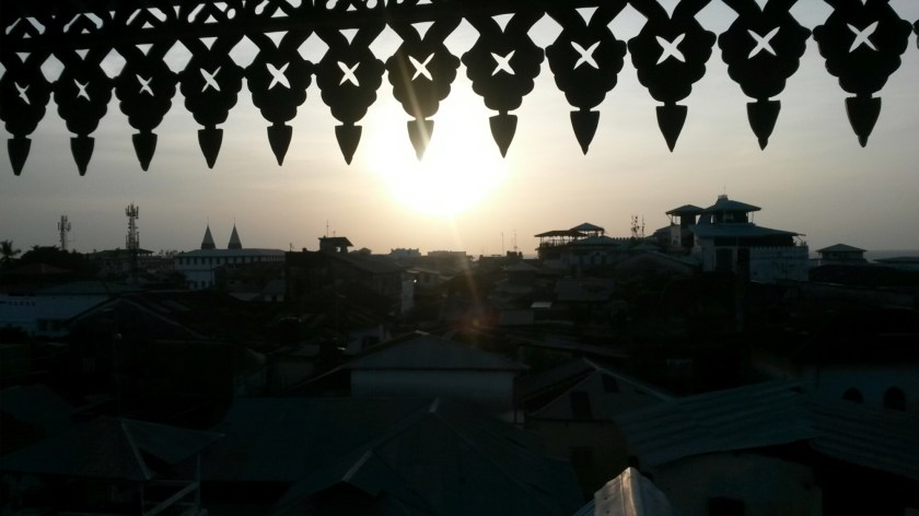
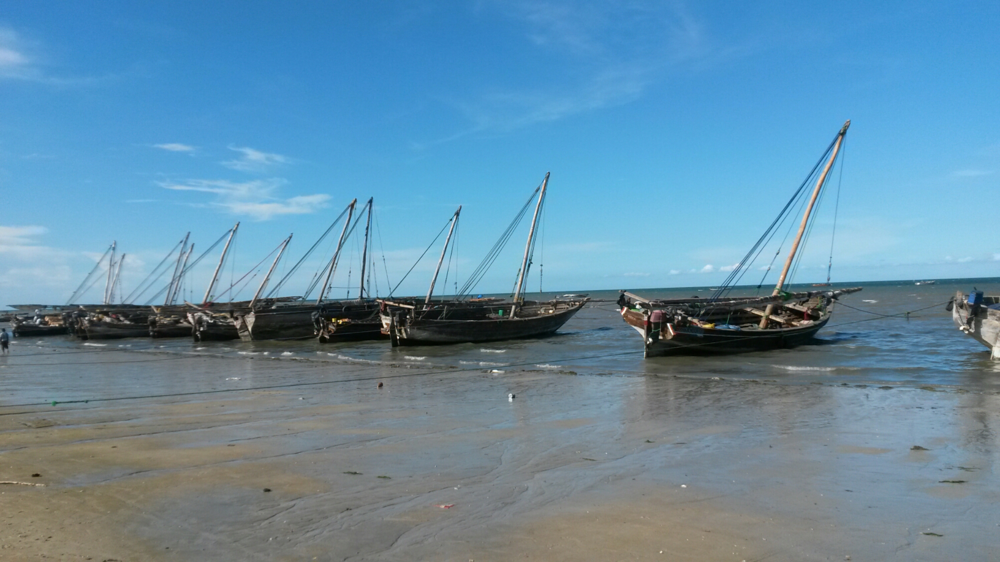
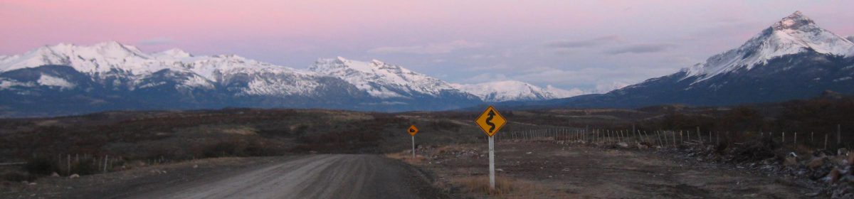
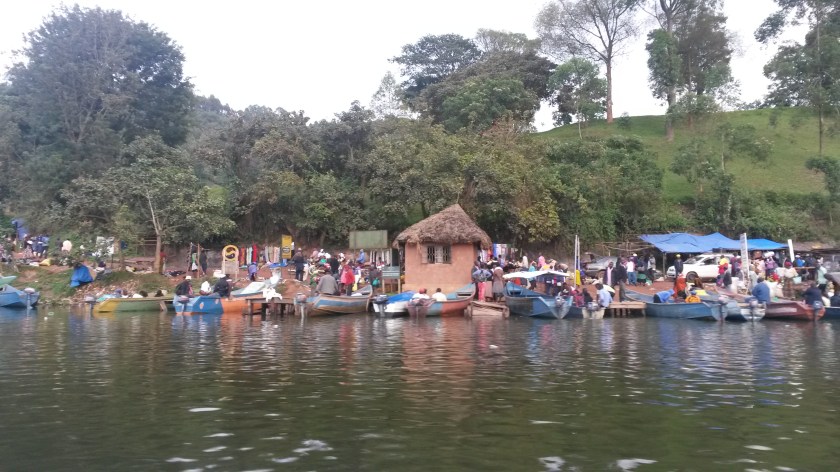
It was a beautiful drive, passing through the lowlands of Queen Elizabeth National Park (unintended safari #2!) and making a brief stop to take a photo at the equator. A dirt road led us up from Kabale to the shores of Lake Bunyonyi, a large freshwater lake at about the same altitude as Lake Tahoe (6,300 feet, it felt like home!) and filled with almost 30 hilly islands of various sizes, many of them inhabited and terraced for farming. As the weather was looking questionable I took a motorboat out to Itambira Island hoping to find lodging in one of their open-air geodomes, but had to settle for a bunk in a dorm room by the water. I immediately jumped into the lake, its cool waters feeling incredibly refreshing after sweating my way through most of East Africa. At night I enjoyed a clear view of the stars and wished I had time to stay longer and just relax, after all of the adventures with getting to the place. I did have the chance to hike around the island the next morning before paddling back to the mainland in a dugout canoe.

20170318_113916
Canoe: the only way to travel

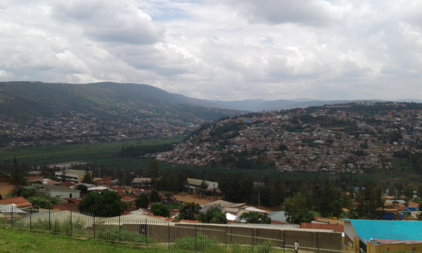
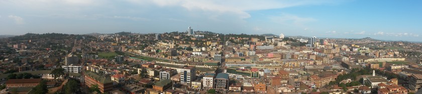
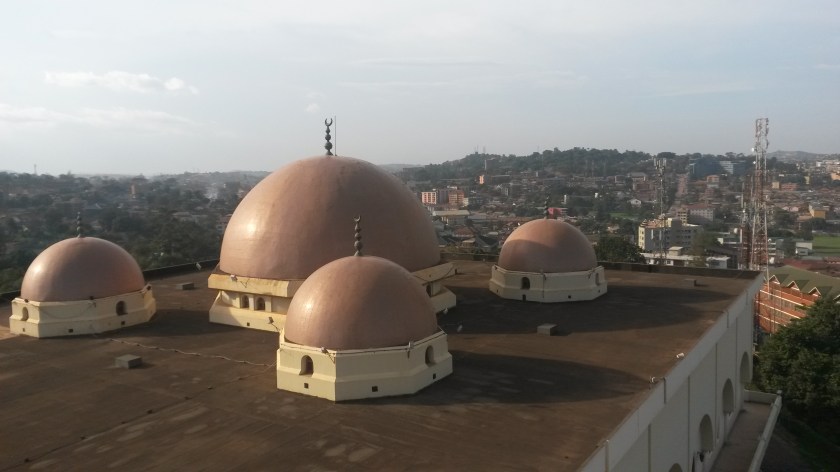
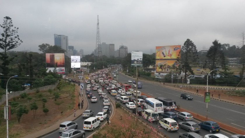
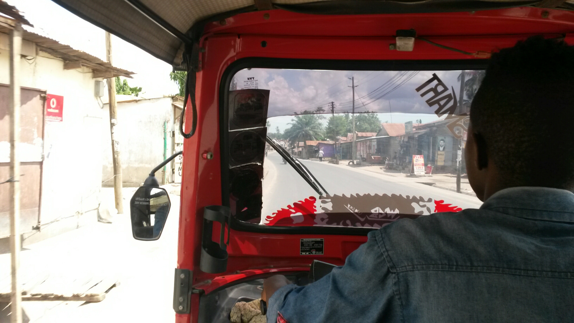
From the shore I arranged a boda-boda to take me to the Rwandan border, about 25 kilometers away. Rwanda was not in my original plan but since I was able to obtain an East Africa Tourist Visa, I figured I should take advantage of the opportunity and spend a few days in the capital, Kigali. With its downtown built at the crest of one of the city’s many hills, Kigali resembled Kampala in some respects. However in others it differed wildly, one distinction being the requirement that boda drivers give their passengers helmets to use while riding (an offer I was more than happy to take advantage of). Traffic was a little less chaotic, and the city also seemed a little less lively. But people were friendly, and though I don’t speak French or the national language, Kinyarwanda, I felt welcome.

20170319_152118
View of downtown Kigali, Rwanda, from the Genocide Memorial

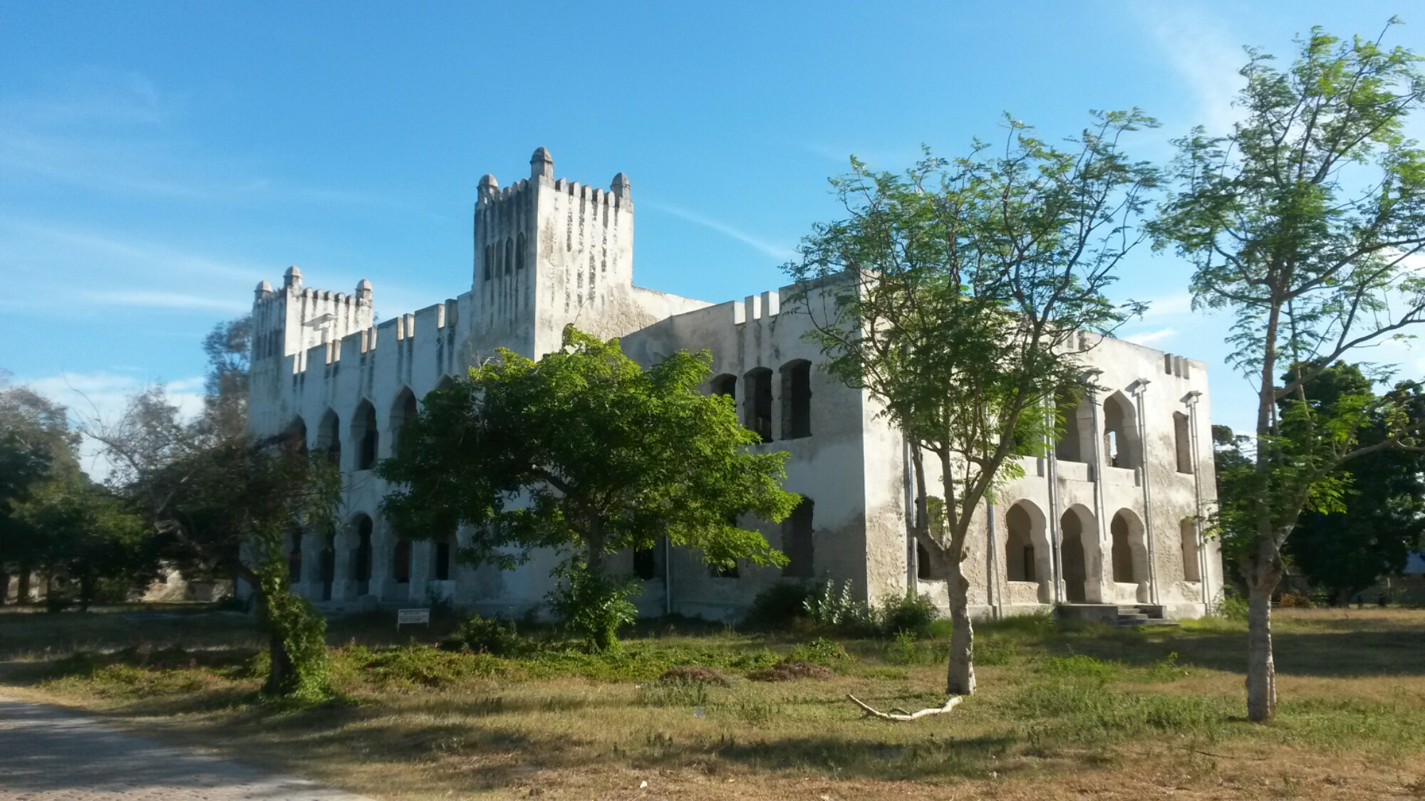
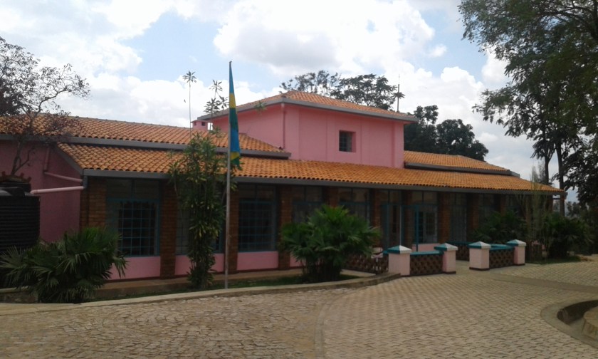
I visited the “first house built in Uganda”, that of German explorer Richard Kandt, which now houses the small Museum of Natural History. Here I learned that the true source of the Nile River is in Rwanda (sorry Uganda) and other interesting facts about the country’s geology and biodiversity. Out back was a large shed that housed a collection of live snakes, including my favorite as a kid, the black mamba! (unfortunately photos were not allowed inside).

20170320_130202
The first house in Kigali, circa late 1800’s

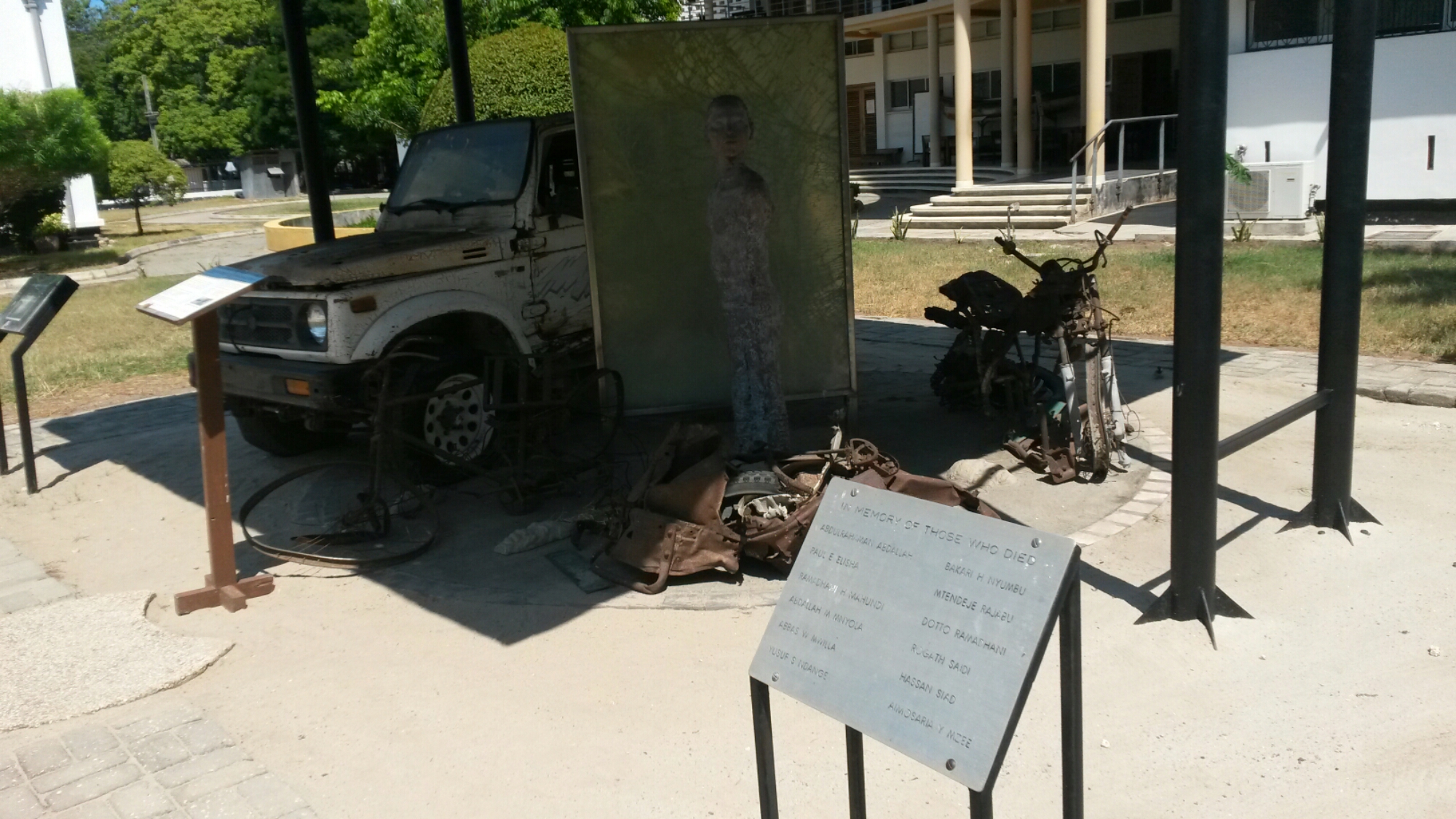
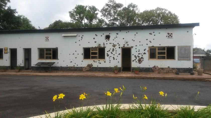
I spent my first full day visiting a couple of memorial sites from the 1994 genocide. With the city seemingly empty on a Sunday morning, I first visited the bullet hole-ridden building at Camp Kigali where 10 Belgian peacekeepers were killed in a (successful) attempt to have Belgium withdraw its contingent at the start of the massacres. The guide had survived the genocide as a teenager and showed me a bullet wound in his leg and machete scar on his stomach. This really reinforced the fact that this is not ancient history (I visited the Killing Fields in Cambodia while traveling around Asia in 2009, which happened over 35 years previously and long before I was born. Rwanda was only 23 years ago; I was 7 years old).

20170319_112006
Building where the Belgian soldiers were killed in 1994

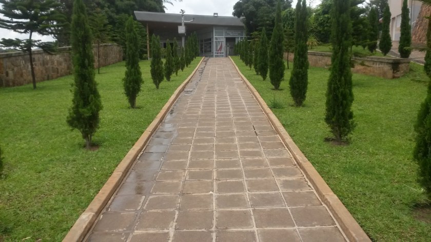
At the Genocide Memorial itself, I watched an introductory video containing powerful testimonies of survivors; powerful not so much in the listing of how many of their family members were killed, but in that the killers were friends and neighbors, people they had grown up with (one woman said, “It is difficult to trust anyone anymore.” Another survivor: “It changes you. You can never go back”). I had a visceral reaction when reading about the atrocities that happened in homes, in churches where people tried to take shelter, on the streets. A room lined with photos of victims (placed there by family members) was haunting, but even more haunting was a room full of skulls and femurs of some of the victims. Outside were a large number of concrete mass graves – I thought there were only two levels, but kept finding more of them (gave a sense of the depressing scale of the tragedy, 250,000 people buried at the memorial alone). Walking through the gardens and greenery provided a much needed respite and space to reflect on what happened, what is happening in the world now and perspective on my own life.

20170319_124613
Entrance to the Genocide Memorial, Kigali

I found in interesting that, according to the museum, Hutu and Tutsi (during the genocide, members of the Hutu majority, especially the Interahamwe militia with the support of the interim government, targeted the Tutsi minority) were originally economic distinctions across all of the 18 tribes in Rwanda. It was only during the colonial period that these identities were made more concrete, being included on citizens’ identity cards and used to control the population by the colonial government. There is much more that I can say about this experience and my reflections, but I will leave it here for now. Rwanda has come a long way since that dark time and I would love to return one day to visit the countryside, the volcanoes, and meet more of the wonderful people.

20170320_122040
Kigali cityscape, Rwanda

Rwenzori Rains

20170316_085132
Rain falling in the Rwenzori Mountains, Uganda

It has been over two months since I flew out of San Francisco and began this journey across three continents. It is also past the halfway point of my trip, and as I start my trek in Turkey I recall fondly (mostly, with the exception of a couple unfortunate bus/matatu rides) the weeks I spent traveling around East Africa. It was my first time anywhere in sub-Saharan Africa, and though I am now in a very different part of the world, I know one day I will return.

20170314_115820
The largest banana tree I have ever seen, growing wild near Fort Portal

Since my arrival in Uganda I had been looking forward to seeing and doing some hiking in the Rwenzori Mountains, the highest mountain range in Africa and home to the continent’s third highest mountain (Mt. Stanley, at 5,109 meters). Without the time or funds to launch a full summit expedition, I opted for a three-day trek among the cultivated lower slopes, walking through a number of villages and culminating in an ascent of 3,000 meter Karangura Peak in the north of the park.


20170315_133700

I set out on the first day with a guide and guide-in-training, walking on a dirt road directly out of the town of Fort Portal toward the countryside. We passed several schools along the way (basically just a single room with chairs and a chalkboard) as well as fields full of banana trees and cassava plants. Climbing to the top of a small hill, we were rewarded with sweeping views of the Rwenzori foothills and valley below dotted with crater lakes (a legacy of the region’s volcanic past). We also visited the famous Amabere Caves, one of the “Seven Wonders of Uganda” according to the guide, with its refreshing waterfall and stalactites that local Toro legend says are the breasts of an ancient princess (they drip a whitish liquid of hydro-calcium carbonate).

20170314_115436
The famous stalactites of Amabere Cave

We stayed the night at an eco-camp consisting of local style bandas where I enjoyed some of the local food and drink (lots of peanut, or “groundnut/g-nut”, sauce and rolex, a fried egg rolled up inside a chapati, along with a variety of herbal teas). The next day my guides led us on a merry stroll around the terraced foothills of the mountains, stopping by villagers smashing river rocks into small stones to sell for use in road-building as well as the house of a local fortune teller. Reading how five short sticks fall into a bowl of water, he foretold my safe return to the US at the end of this trip. I also asked him if I would ever return to Uganda, and he read that I would indeed come back one more time (there is still so much to see in the country!). At the end of the day we entered a tiny village just as the rain started to fall (it was the very beginning of the rainy season) and took shelter in a teahouse, drinking milk tea with bread and watching the drops of water quench the dry earth.


20170315_121506
Traversing the Rwenzori foothills

The major distributor of bottled water in Uganda is called Rwenzori, and I soon found out why as we began the peak attempt in a raging downpour the following morning. Despite a waterproof jacket and boots, I was completely soaked within 20 minutes and was about ready to call it off when we took a break at the ranger station. However we pressed on, two rangers with automatic rifles accompanying our struggle up the steep, muddy hillsides. The head ranger explained that as the park is located along the Congo border rebels from the DRC sometimes enter the park, though it was more of a problem six years ago. Luckily we didn’t meet any rebels but we did encounter a number of people who were in the park without a permit (either passing through or collecting plants), who the rangers proceeded to punish either by slapping them pretty hard in the face, forcing them to walk back up the mountain with us, or both.


20170316_103613-1
It was extremely wet

After endeavoring up the steep path in the rain for hours, the skies finally cleared and we reached the peak of Karangura. Collapsing onto benches to ravenously devour our lunch of chapati, hard-boiled eggs, and (you guessed it) peanuts, I admired the gorgeous view of green mountains falling away into the mist in the distance. We slipped and slid our way down a different (but no less steep) path, spotting some of the giant lobelia plants that are endemic to the high mountains of East Africa. I celebrated our successful summit back in Fort Portal with pizza and beer, and promptly fell asleep exhausted and ready to relax at my next destination, Lake Bunyonyi.


20170316_121542
View from Karangura summit

The Falls and the Forest

20170308_163101

From Kampala I headed north to Uganda’s oldest and largest national park, Murchsion Falls. Traveling with a tour company recommended by my friend, it was about a five hour drive to get there. Just before the park gate we turned onto a dirt road where the driver, Sam, explained, “The tarmac road ends here. Now we are going to experience the dust.” And indeed we did. Faced with a choice between closing the windows to avoid the rolling clouds of orange dust or leaving them open to relieve some of the sweltering heat,  most of us attempted to do both by leaving just a small crack open, which made neither problem better.

20170308_141901
Rolling down the dusty road, Murchison Falls National Park

The falls themselves are very impressive. Almost the entire flow of the Nile River is forced through a narrow, 6 meter wide opening in the rocks and plunges 45 meters into the valley below. An additional falls, named Uhuru (independence), was created in 1962 after extreme rainfall made the Nile flood, burst its banks and create a new channel. We were able to follow a rocky hiking trail right to the top of the falls; standing so close to the Devil’s Cauldron, a churning mass of water and mist, definitely makes one appreciate the force of nature. Across the rocks stood the remains of a bridge over the falls built for the Queen of England’s visit in the 50’s, which had been washed away by the power of the river.

20170308_162234
Murchison Falls, Uganda

We stayed in a camp above the ferry dock on the south side of the Victoria Nile. Immediately upon arriving, our host explained that wild animals, including hippos, baboons, and a family of warthogs, often wandered through the camp and warned us to carry a light at night lest we bump into a wayward hippo and experience its ‘terminal’ bite. I shared a tent with a Serbian-German filmaker who was also visiting a friend in Kampala, another German who is working to develop the Uganda Film Institute. The night passed without incident (hippo or otherwise, although I did spot a warthog tearing up the grass outside the bathroom) and the next day we took a car out to the region between the Victoria and Albert Niles (the river as it flows out of Lake Victoria is called the Victoria Nile, which then enters and flows out of Lake Albert), which is full of buffalo and different species of antelope. The real highlight of the day, however, was a cruise in a small boat 17 kilometers up the river to about 400 meters from the base of the falls. Spotting crocodiles, fish eagles and innumerable hippos from on top of the roof, along with simply watching the lush green banks roll by as the afternoon waned, was pure bliss.

20170309_164915
Full speed ahead on the Victoria Nile

After Murchison Falls I caught a bus to the town of Fort Portal at the foot of the Rwenzori Mountains in western Uganda. Most public buses in Uganda wait until they are fully packed with passengers to depart, and mine was no exception with a three hour wait at the station in Kampala. A woman wearing a bright yellow headscarf sat down next to me and though I was becoming impatient, she was completely exasperated and began berating the bus workers to start the journey. We eventually got going and made it to Fort Portal by midafternoon (I bought a couple roasted bananas for lunch along the way). During a communal dinner at my guesthouse that night I took part in an interesting discussion on Uganda’s unemployment problem, which my host argued would only be solved by young people moving back to their parents’ farms and becoming ‘professional farmers’.

20170309_151659
Young crocodile, Murchison Falls National Park

Instead of gorilla tracking on the Congo border (which costs upwards of $600 for a permit, if you are lucky enough to obtain one) I decided to visit Kibale National Park, where tracking one of the 12 troops of chimpanzees is one of the more unique wildlife experiences in all of East Africa. Following an armed guide into the dense forest (the rifle slung over his shoulder was in case of any encounters with the aggressive forest elephants), my small group discovered some fruit branches that had been picked over by chimps and fresh chimp scat (complete with dung beetles) before spotting one in the bushes ahead. We lost him pretty quickly, but soon discovered an entire group of 15-20 chimps swinging through the trees, grooming one another, and rambling around on the forest floor. These chimps are habituated to the presence of humans and more or less ignored us the entire time, but that didn’t stop me from holding my breath as a large male walked by about 3 feet away. It was fascinating to observe the closest living relatives to humans in the wild, with all of our similarities and differences.

20170313_093359
So like us

The River and the City

20170305_171136
Kampala, Uganda

Kampala is a city of hills and motorbike taxis (known locally as boda-bodas). After crossing the Nile River on the bus in darkness, the only light emanating from some industrial smokestacks nearby, we arrived and hired a ‘special taxi’ to take us to my friend Michael’s house, of which I had the address and the name of a nearby road but not much else. Following a local boda driver (the acknowledged experts in city geography), we eventually found the right street and a woman at the streetcorner kiosk directed us to the right gate.

received_10155229605334444
The bodas of Kampala (photo credit: Meredith Saba)

Mike runs a rent-to-own motorbike business for boda drivers called Tugende, meaning “Let’s go!” in the Luganda language (the most widely used local language in Uganda, spoken mainly by the Baganda people who constitute the largest ethnic group in Uganda, but are still only 17% of the total population). It was fascinating to get his perspective on Ugandan business practices (corruption is rampant, unfortunately, though Tugende maintains a zero-tolerance policy for corruption and keeps it out of its business) as well as politics over a couple bottles of Club, a local beer. I also tried a bit of ‘Uganda Waragi’, a spirit similar to gin often sold in small plastic pouches (because they are cheaper to produce than glass bottles).

received_10155229435864444
Discussing Uganda’s future with Mike

Two hours from Kampala, where the Nile flows north out of Lake Victoria and begins (according to Ugandans, though I was just told in Kigali that the true source is in Rwanda) its 4,000 mile-long journey north to Egypt and the Mediterranean Sea, a number of intense Class IV and V rapids support a fun rafting trip in which Meredith and I were eager to partake. The current raftable section of the Nile is a ways downriver from the original rapids, many of which were flooded with the completion of the Bujagali Dam in 2012 (the goverment is in the process of constructing yet another dam further downriver, which may make the current rapids disappear altogether).

received_10155229523104444
Rapids on the Victoria Nile (photo credit: Meredith Saba)

We met our lead guide Juma (who competed in the London Olympics in 2012), grabbed a life jacket and helmet and jumped into the boat with five other travelers. After practicing flipping the raft in the refreshingly cool waters of the river, we approached the first rapid, known as Overtime. We hit it just as soon as our guide Paolo had time to explain that there is an 8-foot drop at the end, and that it was the most extreme rapid of the day. There was no time to think, about whether we had made a terrible mistake or anything else. Only to duck down and take cover as the raft plunged sideways over the drop off. Miraculously we did not flip, and an exhilirating (and wet) few seconds later we were in calm waters again, looking back at the waterfall we had just gone over as the screams of our fellow rafters subsided into giddy laughter.

IMG_2332
Dropping in to Overtime

Seven more exciting rapids followed, including ‘The Dead Dutchman’ and ‘The Bad Place’, a Class VI that we had to take the rafts out and portage around to avoid. At one point the raft turned almost perpendicular to the water and Paolo was launched into the river, though the rest of us managed to cling on. Watching our fellows in Juma’s boat flip a number of times, I found myself wishing I would be similarly thrown into the brisk water at the next rapid. There were also long stretches of flatwater where we enjoyed pinapple slices and glucose biscuits (ubiquitous in East Africa), and I took every opportunity to dive in, swim around and cool off (no hippos or crocodiles here!).

received_10155229517529444
Meredith and me on the river

The day ended with a BBQ, beers and a carnival trolley back to the main road. Sadly Meredith had to return home and flew back to the US the next day (a 36 hour journey) while I stayed in Kampala to see a bit more of the city, including the recently constructed National Mosque on Old Kampala Hill (fun fact: Kampala is also built on seven hills, like every other city in the world), known as the Gaddafi Mosque to Kampalans as it was built with funds and engineers provided by the late Libyan leader. The idea began with Idi Amin in the 1970’s, however, and it was interesting to talk with my guide about Uganda’s Muslim community while taking in the wide-ranging views of the city from the top of the minaret. I would soon strike out from here to Uganda’s hinterland, where waterfalls, chimpanzees, and Africa’s highest mountain range awaited.

20170305_172004
National (Gaddafi) Mosque, Kampala

Kenya: A Brief Sojourn

20170228_214411
Kenya from a bus

It was two hours from Arusha to the Kenyan border. Meredith and I managed to commandeer a shared van to take us to Namanga to make the crossing. Along the way our driver, Godfrey, suddenly stopped the car on the side of the highway next to another shared van whose driver was speaking with a local Maasai tribesman. Godfrey got out and after a short discussion, a giant semitruck wheel was hauled into the back of our van. He then asked us for a loan of 40,000 Tanzanian schillings (equivalent to about 18 USD) to purchase the wheel from the Maasai, which he would then try to sell in town at a profit. Not fully understanding the situation we were hesitant to hand over the money, but after Godfrey gave us his driver’s license as collateral Meredith relented and we drove on (he was as good as his word and repaid us as soon as we reached Namanga).

20170227_043304
Our trusty steed

The border crossing itself was fairly straightforward (with customs giving just a cursory look into our bags), and I managed to obtain an East Africa Tourist Visa which would allow me entry to Kenya and Uganda, as well as Rwanda. Looking for transport to a safari camp on the far side of Amboseli National Park near Kilimanjaro, a Maasai man approached and told us he could guide our car through the bush. So we hopped back into Godfrey’s van and drove across the arid plain, along rugged dirt tracks and across the dry Amboseli lakebed to our destination (we were completely covered in dust by the end). After passing through a seldom-used park gate we spotted a number of animals along the way to the camp, inadvertently doing yet another safari.

IMG_2090
Flamingoes, Amboseli National Park (photo credit: Meredith Saba)

The main reason we had come to the camp was to enjoy the incredible views of Mount Kilimanjaro from the northern side. Although the peak was shrouded in cloud that day, the next morning we woke to a spectacularly clear view of the highest mountain in Africa, Kibo peak covered in fresh snow (and a very different view than the southern side at that). Feeling lucky and inspired, we caught a ride with another guest (who happened to be from California) to Nairobi, where the crushing traffic slowly chipped away at our good spirits before we were renergized by another beautiful view: the city of Nairobi from the helipad of the Kenyatta Conference Center, named after the first president of Kenya who is also the father of the current president, Uhuru Kenyatta.

IMG_2128
This mountain needs no introduction (photo credit: Meredith Saba)

Sadly our time in Kenya was very limited, and after a delicious meal of fish, beef, and ugali, we taxied over to the bus station to book next-day tickets for Kampala in Uganda. The route to Kampala took us past the edge of the Great Rift Valley and through Kenya’s western highlands, an attractive region of green hills and tea plantations. Kenya is the world’s largest exporter of tea, and watching the bucolic countryside go by from the bus window made me wish I could stay and spend more time exploring this place and meeting its colorful people. But all of Uganda awaits, and as we crossed the border at Busia and the landscape changed to a flatter, lush plateau dotted with thatch-roofed bandas (a village home), banana trees, and the ubiquitous cell phone company advertisement painted on storefronts, I knew the journey was just beginning.

20170228_203901
Traffic in Nairobi

The Parks

Sunrise over Ngorongoro Crater

It seems one cannot come to East Africa without visiting at least one of the spectacular national parks scattered throughout the region. Serengeti, Masai Mara, Murchison Falls: all famous names and all unique in their own way. From Zanzibar Meredith and I decided to travel  to northern Tanzania and join a budget safari to Serengeti, Ngorongoro Crater, and Tarangire National Parks (Ngorongoro is technically a conservation area, which means the Maasai people are allowed to live and graze livestock there). We would have loved to travel overland, but as the bus schedule was not amenable and time was limited we caught a quick flight to the city of Arusha.

Arrival in Arusha via Precision Jet

After an evening meal of beef pili pili (a sort of spicy sauce), pizza, and local apple beer (which tasted neither like apple nor beer), an early morning drive past Mt. Meru took us to the Sunbright Camp where we met our friendly guide, Ziggy, and unsmiling cool, Ali. We were joined by three other travelers, from Italy, Germany, and one guy from Kentucky who provided plenty of color commentary throughout the trip. We rode along a paved highway until we reached the entrance to Ngorongoro, where the road turned to dirt and we began the upward climb through green forested hills to the rim of the crater.

View of Ngorongoro from the crater rim

A long descent through the Crater Highlands followed, with Maasai villages and herds of cattle mixing with the occasional zebra and giraffe. But the real show started when we hit the expansive Serengeti plain and the hundreds if not thousands of zebra, wildebeest, and gazelle that make the southern Serengeti their home this time of year. We also caught sight of a few ostriches, several hyenas, and even a full pride of lions (with cubs play-fighting and all), among many other species. It is hard to imagine the sheer numbers of wildlife that make this place so special. The only analogue I could think of in the US would be Yellowstone, but even that doesn’t truly compare. The sight of a secretary bird searching for snakes in the grass or a lone cheetah stalking through the plains is inspiring, and gives one a sense of raw life that is sometimes hard to find in the urban jungle.

Just a few of the multitudes of wildebeest and zebra in Serengeti (photo credit from here onward to Meredith Saba)

We camped in the middle of the Serengeti Plain (with hyenas and storks wandering among the tents) and then at the rim of Ngorongoro Crater, created by a massive volcanic eruption millions of years ago. The steep hillsides encourage many of the animals to stay within the crater, and the lush vegetation made it an interesting contrast to the dryness of the Serengeti. Troops of baboons climbing the acacia trees, elephants tromping in the distance, and even critically endangered black rhinos grazing peacefully on the green grass gave us a sense of wonderment and awe, and even Ali smiled (a little bit) when he saw how amazed we all were with the experience.

Black rhinocerous, Ngorongoro Crater

Our last stop was Tarangire (named for the Tarangire River that flows through the park), with a new guide named Estommy and new travel companions from Minnesota. Tarangire hosts one of the largest concentrations of African elephants in the world, and we stood spellbound watching the massive creatures pull down branches of leaves with their trunks and amble through the sparse brush (I also couldn’t help but think of Sam’s comment from The Two Towers: “It’s an oliphant, Frodo! No one at home is going to believe this”). By the end of the four-day journey I think we were both exhausted and overwhelmed, and ready for a break. But the adventure doesn’t end here, for the next day we would enter an entirely new country: Kenya.

A pair of lions prowling the Serengeti

Bonus photos!

Acacia Trees, Serengeti National Park
Agama lizard, Serengeti
African Elephant, Tarangire National Park

The Island

Zanzibar. From the winding narrow streets of Stone Town to the turquoise waters off the northern coast, from villagers hawking a local fruit known only by the name ‘purple’ to the hum of food stalls that pop up in the sea-front Forodhani Gardens every evening, the island exudes a unique atmosphere that personifies its location in the Indian Ocean. Located about 40 kilometers from the Tanzanian mainland, the combination of Arab, Indian, and mainland influences is even more pronounced than in Dar es Salaam. And going through passport control upon arrival at the ferry port gives you the feeling that you have entered a new country entirely.

wp-image-976956189jpg.jpg
Zanzibar passport stamp

Indeed, before 1964 the mainland (then known as Tanganyika, after the lake on Tanzania’s western border) and Zanzibar were separate political entities. Although both controlled by the British during the colonial era, Zanzibar had been under the rule of an Omani Arab sultanate for centuries. Following independence from Britain the local African population overthrew the sultanate in a revolution and unified with Tanganyika a few months later to become the present-day United Republic of Tanzania. The island maintains a level of autonomy (hence passport control) and theoretically elects its own president in addition to the President of Tanzania, but tension still simmers beneath the surface between the Zanzibaris and the more powerful mainland politicians.

wp-image-29648323jpg.jpg
Friday Mosque

However this tension can be difficult to find in the laid-back and friendly attitude of the islanders. After meeting my girlfriend Meredith in Dar, we hopped on the midday ferry for the two hour journey to the island. Due to its long history of interaction with Arab traders and sultans the population of Zanzibar is predominantly Muslim, which could immediately be observed in the multitude of white hajj caps and beautifully colored headscarves among the passengers. Earlier we had been warned about the twisting maze of alleys that constitute Stone Town (the historic section of the main city on the island) and the associated difficulty of navigation. Sure enough, as soon as we walked out of the port we became hopelessly lost. Circling the same streets several times in the search for our hotel, we were eventually saved by a helpful local who led us in the right direction.

wp-image-1665381951jpg.jpg
One of Stone Town’s many narrow streets

We took the next few days at a slow pace, soaking in the island atmosphere, enjoying delicious seafood (octopus stew and grilled kingfish – I also tried caviar for the first time; it was ok), and simply getting lost in the labyrinth of streets. We also met up with Meredith’s college friend Megan, who is currently leading a study abroad program in Tanzania and happened to be on Zanzibar at the same time. It was great to learn about the culture and politics of the region from someone who had studied it for so long. Megan also introduced us to some of the local specialties at Forodhani Gardens, including “Zanzibari Pizza” and a tasty stew of many ingredients known as “mix”.

wp-image-1985515825jpg.jpg
Delicious balls of fried dough (zarabiya) at Forodhani Gardens

On our final day on the island we took a dalla-dalla (local minibus with more people than you think possible crammed in) up north to the beach at Kendwa to help achieve my dream of swimming in all of the worlds oceans (you’re next, Arctic!). About halfway to our destination the bus stopped briefly in a village and we were immediately surrounded by vendors selling grilled corn and ‘purple’ fruit, shoving bags full through the open windows. The bus let us off on the side of the main road and a dusty two kilometer walk later we were at the ocean. The turquoise color of the water was surreal, and a few hours swimming and relaxing at the beach with a local ‘Tusker’ beer was the perfect end to our time on the island.

wp-image-940632315jpg.jpg
Sunset over Stone Town

The Coast

The busride to Dar es Salaam was long and beautiful. After boarding the Kilimanjaro Express bus and leaving Moshi about 45 minutes after the scheduled departure time (this is East Africa, after all), we left the shadow of Kilimanjaro and passed by the steep green slopes of the Pare and Usambara mountains on the way down to the coast, with plentiful pineapple plantations and small villages at their base. Stopping a few times to allow herds of cattle to cross the road, what was supposed to be an 8 hour journey turned into 11 hours as the bus constantly became stuck behind slow-moving trucks on the two-lane road into the city.

Downtown Dar es Salaam

I had booked a room at a hotel near the airport in the Ukonga district, across the city from the bus station. With only vague directions my taxi driver needed to ask a local boda boda (motorcyle taxi) to show us the way down a dark, poorly maintained dirt road to the hotel gate. This scenario would replay itself many times over the course of the next two weeks (boda bodas are the local experts everywhere in East Africa, after all).

Riding a bajaji (autorickshaw) through Dar

The following day I came face to face with Dar’s number one problem: traffic. Covering the 15 kilometers across the city to the Kenyan consulate on a bajaji (a three-wheeled open-air vehicle similar to a tuk-tuk in Thailand or autorickshaw in India) took over an hour and a half of dusty travel, complete with white-uniformed traffic police ignoring the horns of frustrated motorists at every intersection. With the help of Japanese engineers, the government has begun construction of an elevated “flyway” that should help alleviate some of the congestion, though when I asked my driver when it would be completed he shrugged and said it was supposed to be completed two years ago.

Replica of the skull of “nutcracker man”, discovered in Olduvai Gorge in 1959

After a quick stop at the Kenyan consulate to confirm that I could obtain an East Africa Tourist Visa at the border (and a lunch of stewed meat and rice), I spent some time in the National Museum exploring a fascinating exhibit on human evolution and Tanzania’s role in the discovery of ancient hominid fossils in Olduvai Gorge near Serengeti. There were also interesting exhibits on Tanzania’s colonial history and the independence movement in the 1950’s and 60’s as well as a small memorial to the 12 people who died in the Al-Qaeda attack on the US Embassy in 1998.

Memorial to the victims of the US Embassy attack

Wandering the streets of Dar es Salaam it is easy to observe the diverse influences that have impacted the make-up of the city, with black African citizens from all parts of the country rubbing shoulders with Arab shopkeepers and Indian fruit sellers. Arab traders have a long history in East Africa (in fact, many Swahili words originally derive from Arabic), and many Indians arrived and established roots during the British colonial era. It is a very lively city and I would love to spend more time strolling through the city center and tasting all of the local foods (many of which are based on ugali, a soft corn-meal dough usually paired with meat or fish).

Lutheran Church in Dar es Salaam

My next stop was the small city of Bagamoyo, located about 70 kilometers up the coast from Dar. In the 19th century it served as an important transit point in the East African slave trade, as slaves from the interior were brought to the port on the way to Zanzibar. It was also here that the Germans established their first colonial capital in East Africa in 1887, before transferring it to Dar in 1891. There are many interesting historical buildings in the city’s old town to wander through, including a caravanserai (lodge for traders) built by the Arabs where I learned a great deal about the city’s history and Tanzanian politics more generally and from the friendly curator. Inevitably when learning I am from the US a discussion on Trump arose, with the curator expressing her support of the new administration for its anti-same sex marriage bent (homosexuality is an extreme taboo in most of East Africa). Some younger visitors who happened to be passing by voiced their support of same sex marriage, and a small argument ensued.

German boma (administrative office) in Bagamoyo

I ended the day walking along the beach where fisherman carried in their dhows (a local boat with a triangular sail) and women sat on the beach cleaning the day’s catch to be sold at the fish market nearby. I bought a coconut and sat looking out over the Indian Ocean, listening to the calls of the fish-sellers blend with those of seabirds as the light slowly faded into dusk.

Dhows lining the shore in Bagamoyo

The Mountain

​Jambo rafiki! (Hello friend!)

Starting the ascent from the Machame Gate

I write this post having successfully climbed the highest peak in Africa. Scaling Mt. Kilimanjaro (19,341 feet/5,895 meters) was certainly an adventure, although a somewhat contained one. With a guide, cook, waiter, five porters and a toilet man (yes, I had a personal toilet tent) all supporting me throughout the 5-day trek, I felt somewhat less an adventurer than a neocolonialist British aristocrat on holiday.

Inside the ‘Mess Tent’

As someone who is used to carrying all my own gear and food on camping trips, it was a bit jarring having a hot meal and pitched tent waiting for me when I arrived at camp every day. It was pleasant having a cup of hot tea brought to my tent every morning, though, and my guide (Joseph, or Commander White) and the rest of the crew were very friendly and fun to have around. I also met a number of other climbers along the way, from Poland, the Netherlands, Italy, Australia, and Demark/Singapore. Since I was attempting the climb solo it was great to have fellow travelers to hang out in camp and swap trail stories with.

Commander White and I on the trail, with Kibo peak in the background

In order to acclimitize to the extremely high altitude we slowly increased the elevation we slept at each night. The first night was 2835 meters, second 3800 meters, and third 3900 meters after ascending to 4600 for lunch then going back down. I also drank more than 4 liters of water (collected from streams and boiled) to help my body adjust. For most of the climb I had no problems and accordingly the standard pace set by the park was excruciatingly slow. This was evident in my taking on average 2-3 hours less than expected to hike the set distance each day, and being the first climber to reach the campsite every afternoon. So when on day 4 Commander White nonchalantly gave me the option to go for the summit that afternoon instead of early the next morning, I jumped at the opportunity.

Mt. Meru at sunrise

After putting on the layers needed to keep warm at the top and getting all of the gear together, CW checked my oxygen level to make sure my body was ready for the altitude. My blood oxygen level was a solid 70 percent, but worringly my resting heartrate hovered around 120 bpm. Not wanting to have a heart attack on top of a mountain, we decided to ascend into the clouds to 4900m and check again. Each time we checked my heartrate eventually dropped back to 120, so CW decided it was ok to press on. At this point we had already hiked 11 kilometers with 5 remaining to Uhuru peak. The altitide finally hit me and I developed a slight headache, with some dizziness and nausea to boot. The final two kilometers before the crest at Stella Point were probably the most difficult I have ever done. Finally, after many breaks, some life-saving ginger tea and CW carrying my backpack as well as his own for the last 100 meters, we made it to the top.

The summit at dusk. It was cold up there.

Descending from the summit to basecamp where we would sleep involved sliding down the steep scree-filled slope by headlamp, which was actually a lot of fun and much easier than going up. It also reminded me a bit of what I imagine Mars would look like, covered in dust and rocks. Unfortunately my headache didn’t go away until we went much lower the next morning, hiking another 20 kilometers and descending some 3000 meters to the exit gate. But with incredible views across the plains to Mt. Meru and beyond, it was easy to forget. We also spotted a troupe of black and white colobus monkeys in the rainforest on the lower slopes just before the trail’s end.

The snows of Kilimanjaro

If you are interested in a more detailed account of the climb, I will post it here in the coming weeks. Tomorrow morning I leave for Dar-es-Salaam (or simply ‘Dar’), the largest city and economic and cultural capital of Tanzania. It will be an all day journey but I am very much looking forward to seeing the countryside and experiencing more of this beautiful country.

Arrival

This morning I opened my curtains at 7am to a view of the two peaks of Mount Kilimanjaro, the early morning sun reflecting off the snows of the higher Uhuru peak. It was a fitting welcome to this great continent, which I had only visited very briefly once before when stopping in Egypt on my Semester at Sea voyage ten years ago.

Mt. Kilimanjaro in the morning light. Uhuru peak is on the left.

It was also a welcome sight after a long journey that began in the wind and rain in San Francisco, where I left my house of three years and took the train to the airport. Unfortunately due to the weather my flight to LA was delayed and I ended up having to rebook on a direct flight to Amsterdam, in hopes of catching my connection to Tanzania in only 25 minutes (IF my flight arrived on time). Luckily the two gates were right next to one another and I barely made it onto the jetway before the crew closed the door and the plane pulled away from the terminal (my luggage was not so lucky). After a quick de-icing of the plane’s wings, we were off to Africa.

De-icing the plane in Amsterdam

Landing at Kilimanjaro airport (about halfway between the cities of Arusha and Moshi in northern Tanzania) was rather chaotic, with many European vacationers ready for safari disgruntled at having to wait to obtain a visa and go through passport control. Eventually I made it through (sans luggage), met Jennie from my Kilimanjaro guiding company outside and made the quick 45 minutes drive to my hotel in Moshi along the darkened highway, the only light coming from the oncoming headlights of the many trucks we passed.

Arrival at JRO

Most of today was spent preparing for my upcoming climb of Kilimanjaro (I start on the trail tomorrow!), meeting my guide (who goes by the moniker “Commander White”) and renting some of the required gear for the six-day trek. I did have a chance to walk around Moshi for a bit and take in some of its busy atmosphere and interesting landmarks, including the local mosque and Hindu temple. I also met a local named KB who showed me to a small corner eatery for lunch, where I feasted on roast chicken and rice.

Mosque in downtown Moshi

We start for the mountain in the morning with a drive to the Machame gate followed by 11 kilometers to the first camp at 2,850 meters (9,350 feet). I will be slowly acclimitizing for the next several days until attempting the summit on the 14th. Keep your eyes open for the next post!