Day 17: Mather Pass to Grouse Meadow

IMG_3324

Mather Pass has one defining characteristic: a 15-foot wall of snow at the apex that hikers must climb straight up and over, with a very long and steep drop waiting if you fall. My heart rose to my throat as stepped into boot tracks that became smaller and smaller as I ascended, until there were no tracks left. Tossing my ice axe and trekking pole onto the ledge above, I breathlessly scrambled onto the relatively flat crest to the sound of clapping from a group taking a snack break at the top. They had come up the north side of the pass, and while I watched them one by one begin to descend the precarious snow wall I was grateful to have gone up the south side instead of down.

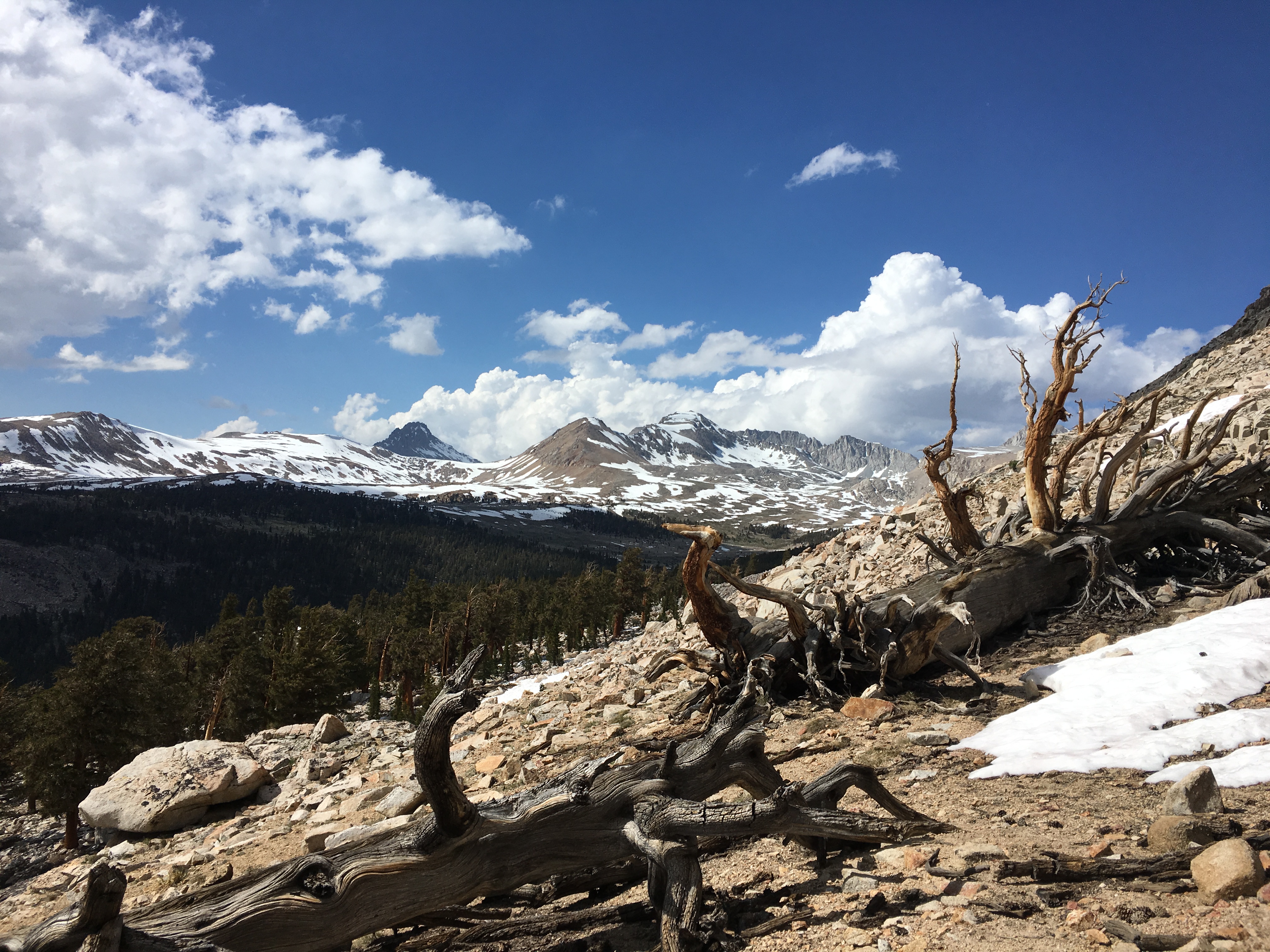
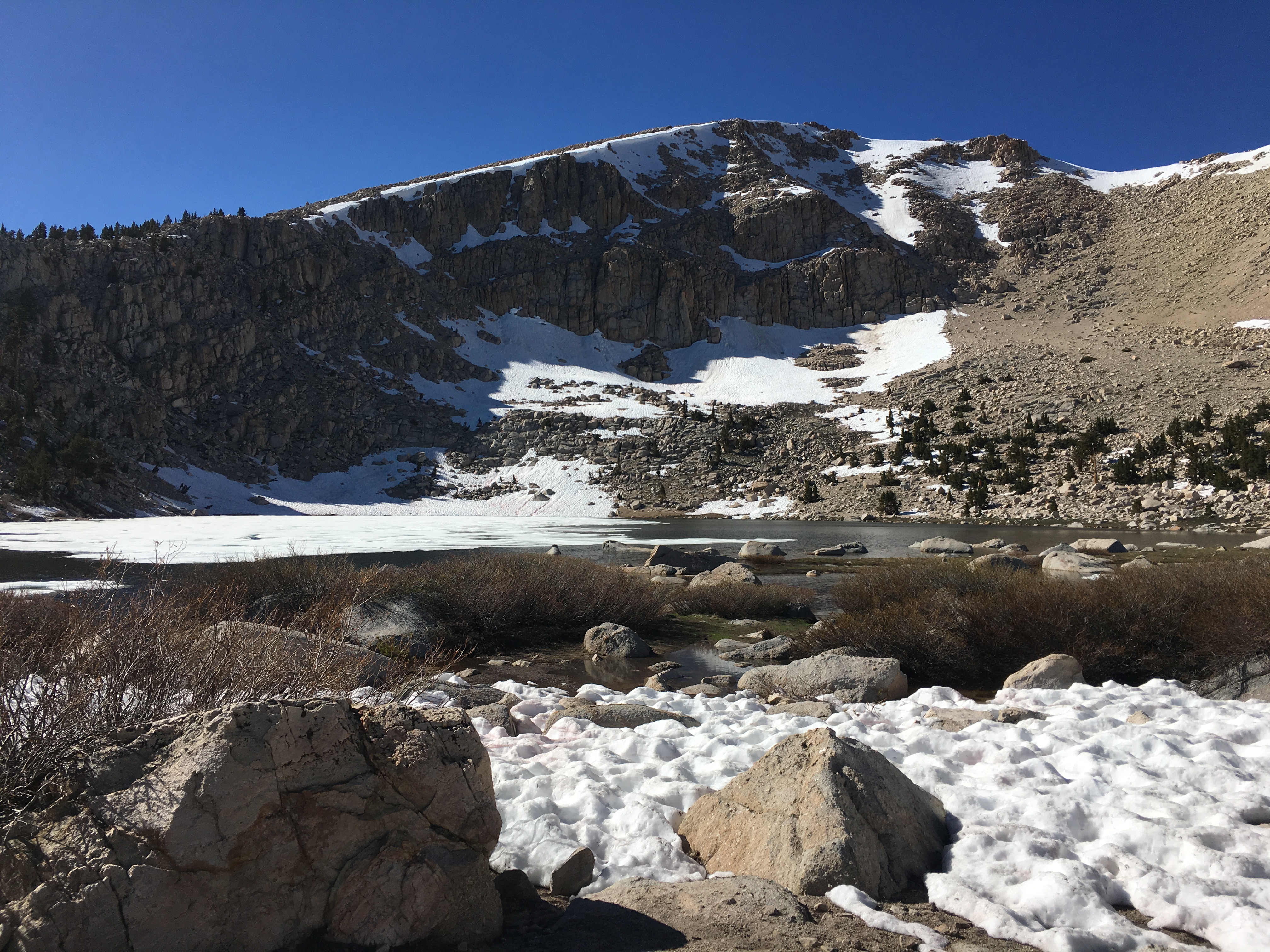
Hiking down into the Palisade Valley was like entering a frozen wonderland at the very edge of spring. Waterfalls sprang from every direction, flowing into two large lakes half covered in ice and half in deep blue glass. We ran into my old pal Bubblewrap’s group as they lazed on a rock in the sun and spotted several furry marmots on our way out of the paradisaical valley, following a trail that often disappeared under several inches of water. Navigating over and under fallen trees, we continued north and set up camp at the edge of a grassy meadow beneath granite spires.

Day 16: Pinchot Pass to Mather Pass

IMG_3263

Hiking over Pinchot Pass was easier than the previous two passes, but it still involved a long uphill slog through large snowfields and scrambling across a couple of treacherous outcrops of razor sharp rocks. By this time I had grown somewhat used to the High Sierra landscape of barren, brown peaks dusted with snow and interspersed with forested river valleys. It contrasted greatly with the mostly tree-covered mountains and gray granite in the Tahoe area where I grew up, only a few hundred miles to the north but significantly lower in elevation.

From Pinchot the track wandered down to the South Fork Kings River where a ranger had posted a sign warning not to cross the raging waterway at the trail. Instead we followed the ranger’s suggestion to trek upriver for 1.5 miles to a green meadow where the river braided into five or six smaller streams. Incidentally this was also the only point along the entire PCT when a ranger checked my permit. After a couple of false starts we managed to find the crossing and rejoin the PCT on the other side, winding its way back up toward the river’s headwaters and Mather Pass.

Day 15: Arrowhead Lake to Pinchot Pass

IMG_3219

At the bottom of Arrowhead Lake a deep and wide outlet flowed down the valley into the south fork of Woods Creek. Luckily it was moving at a slow, lazy pace and though cold, crossing the thigh-deep stream did not pose much of a challenge. The tributary led us down to its confluence with the main current, where this remote (and rather convenient) suspension bridge spanned the creek.

A long, hot climb followed as we made our way along the rushing creek and across tumbling side streams to Pinchot Pass, named for the first director of the US Forest Service. Setting up camp on a hilltop just before the pass, I attempted to collect some water by filling my bottle with snow and placing it on a rock in the sun to melt, which turned out to be very inefficient in the rapidly cooling evening air. I sat out under a half moon watching the sun disappear behind the ridgeline, painting the mountains in pink alpenglow.

Day 14: Kearsarge Pass to Arrowhead Lake

IMG_3202
Upper Rae Lake, with Glen Pass in the background on the right

After recrossing Kearsarge Pass we took the high trail back to rejoin the PCT, following a catwalk with gorgeous views as it passed above Bullfrog Lake. Almost immediately Glen Pass loomed ahead. Passing next to a frozen lake and into expansive snowfields beginning to melt in the midday sun, we caught up to a group of hikers from LA struggling to lug themselves and their packs through the heavy snow. A series of snowed-in switchbacks near the top necessitated a steep scramble up loose scree, my feet sliding back down half a step for every step forward.

We stopped to rest and eat lunch at the crest of the pass where a panorama of the Rae Lakes Basin spread out below. Before we could get to the lakes, however, we had to safely descend down another imposing wall of snow and ice. A pair of hikers we had met coming the other way had advised us to take the middle of three sets of boot tracks to avoid getting too close to the cliff. Looking out and seeing four distinct paths of prints traversing the snow, I was momentarily at a loss. But there was nothing for it, so we gauged the options and started down one of the two middle paths, hoping it would not lead to a fall over the cliff face and sudden end to the trek.

After some scary initial slips on the ice in the shadow of the pass, we soon arrived in soft afternoon snow and slowly made our way down to the lakes. Glittering waterfalls flowed over the trail into Upper Rae Lake, where I decided to take an invigorating plunge into the cold water. The snowmelt lake felt even colder than Lake Tahoe in the winter, and gasping I immediately climbed out and onto a sunny rock to dry off and watch the deepening blue sky of evening.

Day 12: Bubbs Creek to Onion Valley

IMG_3129

Having nearly run out of food after seven days in the wilderness, it was high time to resupply. The only trouble was, the closest trailhead with a decent road into town lay on the whole other side of yet another near 12,000 foot pass. Thankfully, crossing Kearsarge Pass didn’t pose too much difficulty, and after a pleasant lunch on a sunny rock at Bullfrog Lake we ambled through a few minor snowfields and up some gentle switchbacks to the top.

On the way down to Onion Valley trailhead, we passed a fair number of day hikers and a few families out for a weekend camping trip. We had just reached the parking lot when a day hiker named Bill who I had briefly spoken with on the trail came down behind us. I asked if he would let us hitch a ride with him to the tiny town of Independence at the highway junction below. Not only did Bill give us a ride in the bed of his pickup truck, he also kindly offered some vegan chocolate shakes for us to quench our thirst during the short trip down! As I sat sipping my shake in the truck bed, back propped up against the cab and legs splayed out lazily before me, I watched the surrounding mountains slowly recede into the desert valley and felt content.

Day 11: Tyndall Creek to Bubbs Creek

IMG_3097

Forester Pass. The very name strikes fear into the hearts of many a thru-hiker (at least in a high snow year). While Whitney posed a significant challenge, it’s an optional side trip from the PCT and only involved one tricky snow traverse (which you could avoid by scrambling straight up the rocks). But there is no avoiding Forester Pass. You either go over it, or go back.

The approach started easy enough as we followed a well-worn boot track across gently sloping snowfields. As we closed in on the pass, I kept looking out for where the trail might pass over the jagged line of mountains in front of us. By the time we arrived at the base of the peaks, with a very solid-looking wall of ice and rock directly ahead and the distant trail appearing more than 300 feet straight above, I was feeling very intimidated. I tried to practice self-arresting with my ice axe, but with the snow covered in uneven bumps from the constant cycle of melting and refreezing, I didn’t have much luck gaining speed in the relatively safe area near the bottom. So I strapped on my nanospikes, grabbed my pack, and started up the ice.

I initially followed a zigzag track upwards, stopping for brief rest breaks in occasional dry patches of broken granite. This method soon exhausted me and I changed tack to follow a shallow path of bootprints straight up the ice wall. This worked ok until I came to a point where the upward track disappeared and another set of boot impressions appeared about six feet off to the left, with only a tiny foothold in between. I would need to awkwardly cross one leg over the other in order to get to the new track, a balancing act in normal conditions and downright dangerous on the side of an ice wall 200 feet above the valley floor. I paused for a minute to calm my nerves, readied my ice axe, and took a couple of quick but steady steps across.

Several switchbacks and a snow chute later, I was at 13,200 feet looking down into the first deep valley of Kings Canyon National Park, my trail home for the next 75 miles.

Day 10: Crabtree Meadow to Tyndall Creek

IMG_3048

After the challenging climb of Mt Whitney, we decided to take an easy day meandering our way to the base of Forester Pass. Although low in terms of mileage, the hike involved three large creeks that required careful planning to cross safely. At Tyndall Creek, we followed a pair of German hikers about a third of a mile upstream to where the creek split into three tributary streams. Stepping my sandaled feet into the icy, fast-flowing water was both exhilaratingly refreshing and slightly painful at the same time.

As I started to doze off for the night a sudden shaking rocked the tent, jolting me fully awake. A magnitude 7.1 earthquake had struck near the town of Ridgecrest (about 100 miles to the southeast). It was the most powerful quake to hit California in 20 years, and though I had previously experienced plenty of earthquakes while living in Lake Tahoe and the Bay Area, this was the first time I had felt one while lying in a tent in the middle of the wilderness. Disconcerted, I slowly settled back down to sleep, hoping that the quake had not dislodged any large boulders on the high pass we had to cross the next day.

Day 8: Chicken Spring Lake to Crabtree Meadow

IMG_2936

“You should count that as a bonus mile,” a climber said to me as I came back to camp after digging a cathole as far from the lake as I could get in the snow-filled cul-de-sac. I had been pushing myself fairly hard in order to get to Mt Whitney by the 4th of July, and had another 17-miles to the staging area at Crabtree Meadow. Not wasting any time, I started out and soon crossed the boundary line into Sequoia National Park, the first park of the trail.

The day also included the first significant creek crossing at Rock Creek. Having heard the horror stories about hikers being swept downstream and drowned by the swift currents, combined with the high snow levels and being alone, I ate my lunch while nervously waiting for another hiker to come along and make sure I didn’t die. I later learned my caution was needless as a German hiker I had met in Kennedy Meadows appeared from the other direction (although he did so after hearing of treacherous conditions on the passes to the north, which did nothing to ease my nerves). I crossed over the creek on a solid but obstacle-ridden log, and trudged my way through another broad, slow-moving creek to camp at Crabtree.

Day 7: Death Canyon Creek to Chicken Spring Lake

IMG_2919

After a beautiful sunrise, I trekked up to a ridge overlooking the desert valley to the east. I passed a hiker talking on his phone, likely one of the final spots with cell service before we got into the remote Sierra wilderness. The trail then took a long circle around the appropriately-named Horseshoe Meadow, a popular entry point to the high mountains with a narrow road snaking back down to the town of Lone Pine.

In the late afternoon I reached the junction for a short spur trail to Chicken Spring Lake, where a thru-hiker wearing a kilt was filtering water at the lake’s outlet. At an elevation of 11,000 feet, a thin sheet of ice still covered the shady side of the lake, and the surrounding snowfields made finding a dry spot for my tent difficult. Luckily a friendly section hiker had staked out a small clearing, and as dusk descended several more hikers rolled into the makeshift camp. A large blister had formed on the inside of my left foot, and previous attempts to drain it myself ended in miserable failure. So I was even more lucky when another section hiker stopped to make dinner at the lake and kindly showed me how to properly deal with the increasingly painful blister. Enjoying the company, we swapped stories and advice before the cold and exhaustion sent everyone to their sleeping bags.

Day 6: Monache Meadow to Death Canyon Creek

IMG_2873

I left the Kern River and its magical bridge behind, passing a small garter snake sunning itself in the trail as I hiked out of the meadow. During a long climb that criss-crossed a small but strongly flowing stream, I came across a number of vibrant snow flowers growing out of the needle-strewn ground. Based on the high snow levels through the previous winter and spring, and everyone from fellow hikers to a local rancher back in Inyokern warning me of difficult conditions in the High Sierra, these plants were surely a sign of the snow to come.

Indeed, after reaching the ridge I came across my first tiny patch of snow along the trail. That morning I had made tentative plans to meet John for lunch at the high point, but with him nowhere to be found I continued down through some buggy meadows until finding a nice dry spot to camp in the rocks above Death Canyon Creek (much nicer that it sounds). Unfortunately instead of mosquitoes the site turned out to be infested with ants, and I quickly downed my dinner and took shelter to watch the stars flicker into sight through the mesh ceiling of my tent.