Leaving Kennedy Meadows (after a hot coffee and hearty egg sandwich, of course), I followed the trail north along the Kern River and through a large burn zone. I stopped in the shade at the crest of a hill to have lunch with a hiker from LA named John, who was out for a week-long trek and would be leaving the trail after only seven days via Kearsarge Pass and Onion Valley.
We hiked together for the rest of the day through an expansive subalpine meadow scattered with pink and yellow wildflowers, and eventually reached a popular campsite on the bank of the south fork of the Kern. A bridge crossed the river nearby, and when I walked over to filter water for dinner seemingly hundreds of swallows were flitting around from underneath. A glance under the bridge revealed this large colony of mud-built swallow nests as the birds continued to dart to and fro, catching insects (keeping the mosquito levels at the camp pleasantly low). I sat down below the bridge to watch the swallows as evening rolled in, and the serenity of that moment continues to be one of my fondest memories of the entire trek.
As I was sipping some tea and making breakfast at the creek (where I forgot my lightweight titanium cup, a mistake that would leave me cupless for the rest of the trek) I met two more hikers: Bubblewrap and Pioneer, from the UK and South Africa, respectively. They invited me to share breakfast at a nearby campsite with picnic tables, striking a friendship that would continue as we crossed paths throughout the rest of the California section of the trail.
Pioneer and Bubblewrap wisely chose to wait out the afternoon heat under the shade of a jury-rigged tarp, but lacking a tarp of my own and with the few trees rather stumpy or burned and dead, I pushed on through the stifling heat to the next water source. The intense sun combined with attacks by biting flies every time I tried to take shelter next to a tiny bush forced me to continue, but I was eventually rewarded with an amazing rest break at a beautiful little oasis where the trail crossed Manter Creek. After drinking my fill at a small waterfall flowing into a grass-filled pool, my spirits lifted and the next few miles to the Kern River passed quickly.
I spent the evening quenching my thirsty feet in the cool river and watching the shadows slowly lengthen as the sun disappeared behind the cliffs to the west.
While I missed the majority of the desert section of the PCT by starting at Walker Pass, my few days spent trekking among cactus and joshua trees on the way to Kennedy Meadows gave a glimpse of the awesome beauty that this region can offer. Luckily, my timing coincided with the blooming of these prickly pear cacti, which lined the trail for much of my second day.
I also met my first fellow thru-hiker, trail name Diesel, while filtering water at a small stream surrounded by bees. We chatted while the insects hovered around us and kept flying annoyingly close, and continued to jump past each other on the trail through the afternoon as I attempted to make up for my late start the previous day.
To my surprise, toward evening the desert flora suddenly gave way to pine forest as I crossed over a ridge. The stark difference between the southern and northern flanks of mountains would be a continuous theme on my journey along the trail.
I got off to a late start after waiting out the midday desert heat in an air-conditioned burger joint in the tiny town of Inyokern, just a few miles east of the trail in southern California. Climbing up to the ridgeline from the highway beneath circling vultures, I was soon rewarded with expansive views of the arid Indian Wells Valley to the east. As the sun began its slow descent westward, the mountains took on pink, purple, and bluish hues. I spent a windy, sleepless night up on that ridge on the side of Mt Jenkins, but the striking sunset and then early morning sunrise over the mountains made it well worth it.
Hello everyone! It has been quite a while since I’ve updated this site (almost three years in fact), and a lot has happened in that time. I was waylaid on the Black Sea trek and decided to hike the Lycian Way on Turkey’s Mediterranean Coast instead, which ended up being an incredible experience. I moved to Seattle and got a master’s degree. I trekked 1,800 miles of the 2,600-mile-long Pacific Crest Trail. And finally, I got a job at Stanford (my alma mater) and moved back down to the Bay Area in February.
Since I am now spending much (read: all) of my time at home due to the COVID-19 pandemic, I have decided to get back into writing. I hope to continue my travel blog posts on experiences in Turkey and elsewhere, but I will also try out some different formats as I get my very rusty writing chops back into shape. In that spirit, today I was inspired to begin a series of photos with commentary, one from each of my days on the PCT. Enjoy!
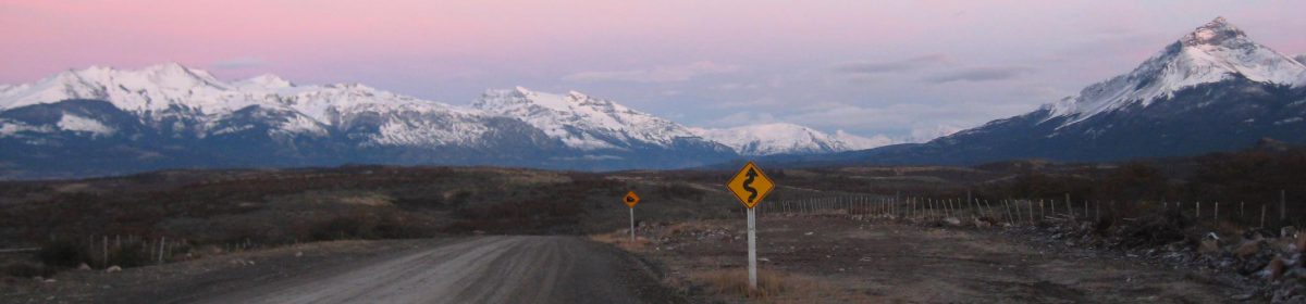
Today’s photo is from my starting point at trail mile 652 (south to north), Walker Pass.
It has been over two months since I flew out of San Francisco and began this journey across three continents. It is also past the halfway point of my trip, and as I start my trek in Turkey I recall fondly (mostly, with the exception of a couple unfortunate bus/matatu rides) the weeks I spent traveling around East Africa. It was my first time anywhere in sub-Saharan Africa, and though I am now in a very different part of the world, I know one day I will return.
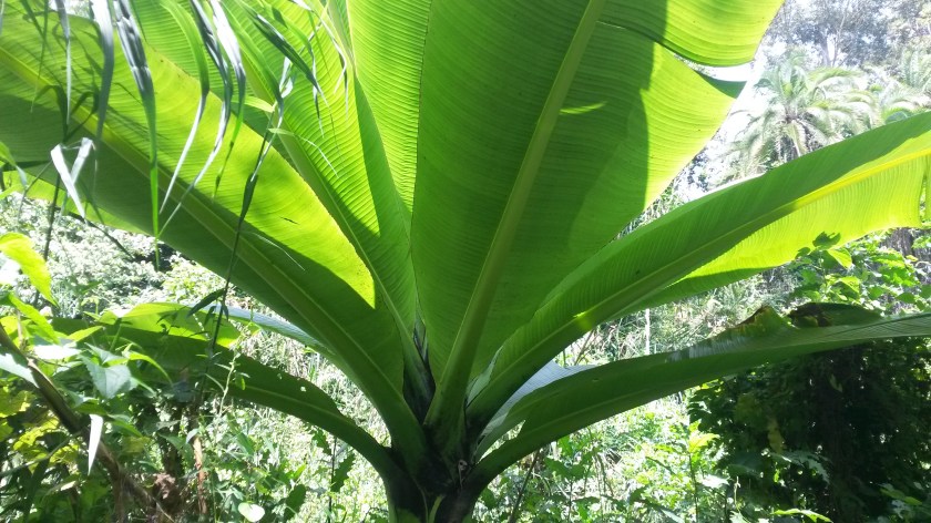
The largest banana tree I have ever seen, growing wild near Fort Portal
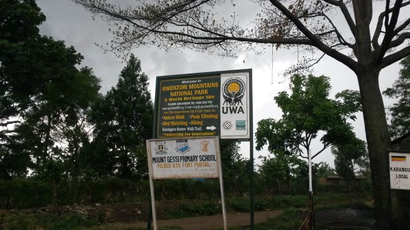
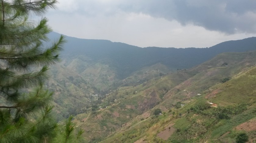
Since my arrival in Uganda I had been looking forward to seeing and doing some hiking in the Rwenzori Mountains, the highest mountain range in Africa and home to the continent’s third highest mountain (Mt. Stanley, at 5,109 meters). Without the time or funds to launch a full summit expedition, I opted for a three-day trek among the cultivated lower slopes, walking through a number of villages and culminating in an ascent of 3,000 meter Karangura Peak in the north of the park.
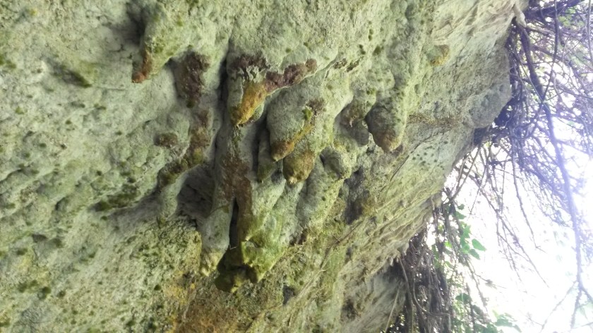
I set out on the first day with a guide and guide-in-training, walking on a dirt road directly out of the town of Fort Portal toward the countryside. We passed several schools along the way (basically just a single room with chairs and a chalkboard) as well as fields full of banana trees and cassava plants. Climbing to the top of a small hill, we were rewarded with sweeping views of the Rwenzori foothills and valley below dotted with crater lakes (a legacy of the region’s volcanic past). We also visited the famous Amabere Caves, one of the “Seven Wonders of Uganda” according to the guide, with its refreshing waterfall and stalactites that local Toro legend says are the breasts of an ancient princess (they drip a whitish liquid of hydro-calcium carbonate).
The famous stalactites of Amabere Cave
We stayed the night at an eco-camp consisting of local style bandas where I enjoyed some of the local food and drink (lots of peanut, or “groundnut/g-nut”, sauce and rolex, a fried egg rolled up inside a chapati, along with a variety of herbal teas). The next day my guides led us on a merry stroll around the terraced foothills of the mountains, stopping by villagers smashing river rocks into small stones to sell for use in road-building as well as the house of a local fortune teller. Reading how five short sticks fall into a bowl of water, he foretold my safe return to the US at the end of this trip. I also asked him if I would ever return to Uganda, and he read that I would indeed come back one more time (there is still so much to see in the country!). At the end of the day we entered a tiny village just as the rain started to fall (it was the very beginning of the rainy season) and took shelter in a teahouse, drinking milk tea with bread and watching the drops of water quench the dry earth.
Traversing the Rwenzori foothills
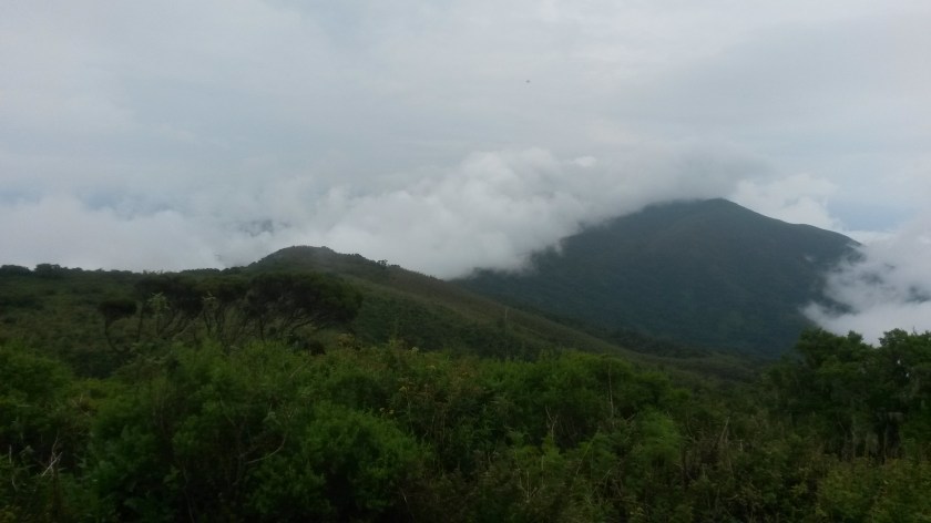
The major distributor of bottled water in Uganda is called Rwenzori, and I soon found out why as we began the peak attempt in a raging downpour the following morning. Despite a waterproof jacket and boots, I was completely soaked within 20 minutes and was about ready to call it off when we took a break at the ranger station. However we pressed on, two rangers with automatic rifles accompanying our struggle up the steep, muddy hillsides. The head ranger explained that as the park is located along the Congo border rebels from the DRC sometimes enter the park, though it was more of a problem six years ago. Luckily we didn’t meet any rebels but we did encounter a number of people who were in the park without a permit (either passing through or collecting plants), who the rangers proceeded to punish either by slapping them pretty hard in the face, forcing them to walk back up the mountain with us, or both.
It was extremely wet
After endeavoring up the steep path in the rain for hours, the skies finally cleared and we reached the peak of Karangura. Collapsing onto benches to ravenously devour our lunch of chapati, hard-boiled eggs, and (you guessed it) peanuts, I admired the gorgeous view of green mountains falling away into the mist in the distance. We slipped and slid our way down a different (but no less steep) path, spotting some of the giant lobelia plants that are endemic to the high mountains of East Africa. I celebrated our successful summit back in Fort Portal with pizza and beer, and promptly fell asleep exhausted and ready to relax at my next destination, Lake Bunyonyi.