Day 19: Sapphire Lake to San Joaquin River

IMG_3451

By the morning Meredith’s leg was feeling better and we set out into the valley, passing by the very serene Evolution Lake and watching fat marmots pop in and out of nearby jumbles of gray rocks. I had been warned that Evolution Creek posed a potentially dangerous crossing at the trail (hikers have been known to get swept away by the current, especially in high snow years) so we took an alternate route through a mud-filled meadow to cross at what turned out to be a relatively deep, but wide and shallow, section of the creek. The other side proved to be equally muddy.

A long, steep descent past gnarly old juniper trees followed, until we arrived at the valley floor and a pair of bridges across the South Fork of the San Joaquin River, which eventually flows all the way into San Francisco Bay. We camped next to the river, and as this would be our final night in Kings Canyon National Park I decided to build my one and only campfire on the trail to celebrate.

Day 18: Grouse Meadow to Sapphire Lake

IMG_3364

The approach to Muir Pass was long, but mostly it was snowy. For almost three full miles leading up to the crest, we tramped past frozen lakes and infrequent rock outcroppings through deepening snow. Bubblewrap, Pioneer, and an Australian friend played catch up with us as we took turns hiking past each other. At last, after a final push up a steep snow hill, we reached the stone beehive-esque shelter at the top. Having been assaulted by blinding light reflecting off the snow for much of the morning, the inside of the hut appeared pitch dark. Soon my eyes adjusted, and together with a large group of international hikers I put my feet up and enjoyed a well-deserved bag of peanut M&Ms.

The trail north of the pass looked straight from the planet Hoth. Glinting ice and snow surrounded us as we slogged our way along the melting boot track, trying to make it to a flat, dry spot to camp before sundown. Beautiful icicle blue water peeked out from the completely frozen Wanda Lake. We crossed sketchy snow bridges, hoping that they wouldn’t collapse and send us into the freezing water running underneath. The sun was approaching the mountain peaks to the west when Meredith started complaining of a sharp pain in her leg. We slowed our pace and took several rest breaks, aiming to get to the next campsite at Evolution Lake. But the pain grew worse, so I decided to set up an emergency camp on a tiny ledge overlooking Sapphire Lake. The view was breathtaking, and while Meredith rested in the tent I watched the last rays of the sun disappear while the moon rose behind Mount Huxley, feeling the cold seep in.

Day 17: Mather Pass to Grouse Meadow

IMG_3324

Mather Pass has one defining characteristic: a 15-foot wall of snow at the apex that hikers must climb straight up and over, with a very long and steep drop waiting if you fall. My heart rose to my throat as stepped into boot tracks that became smaller and smaller as I ascended, until there were no tracks left. Tossing my ice axe and trekking pole onto the ledge above, I breathlessly scrambled onto the relatively flat crest to the sound of clapping from a group taking a snack break at the top. They had come up the north side of the pass, and while I watched them one by one begin to descend the precarious snow wall I was grateful to have gone up the south side instead of down.

Hiking down into the Palisade Valley was like entering a frozen wonderland at the very edge of spring. Waterfalls sprang from every direction, flowing into two large lakes half covered in ice and half in deep blue glass. We ran into my old pal Bubblewrap’s group as they lazed on a rock in the sun and spotted several furry marmots on our way out of the paradisaical valley, following a trail that often disappeared under several inches of water. Navigating over and under fallen trees, we continued north and set up camp at the edge of a grassy meadow beneath granite spires.

Day 16: Pinchot Pass to Mather Pass

IMG_3263

Hiking over Pinchot Pass was easier than the previous two passes, but it still involved a long uphill slog through large snowfields and scrambling across a couple of treacherous outcrops of razor sharp rocks. By this time I had grown somewhat used to the High Sierra landscape of barren, brown peaks dusted with snow and interspersed with forested river valleys. It contrasted greatly with the mostly tree-covered mountains and gray granite in the Tahoe area where I grew up, only a few hundred miles to the north but significantly lower in elevation.

From Pinchot the track wandered down to the South Fork Kings River where a ranger had posted a sign warning not to cross the raging waterway at the trail. Instead we followed the ranger’s suggestion to trek upriver for 1.5 miles to a green meadow where the river braided into five or six smaller streams. Incidentally this was also the only point along the entire PCT when a ranger checked my permit. After a couple of false starts we managed to find the crossing and rejoin the PCT on the other side, winding its way back up toward the river’s headwaters and Mather Pass.

Day 12: Bubbs Creek to Onion Valley

IMG_3129

Having nearly run out of food after seven days in the wilderness, it was high time to resupply. The only trouble was, the closest trailhead with a decent road into town lay on the whole other side of yet another near 12,000 foot pass. Thankfully, crossing Kearsarge Pass didn’t pose too much difficulty, and after a pleasant lunch on a sunny rock at Bullfrog Lake we ambled through a few minor snowfields and up some gentle switchbacks to the top.

On the way down to Onion Valley trailhead, we passed a fair number of day hikers and a few families out for a weekend camping trip. We had just reached the parking lot when a day hiker named Bill who I had briefly spoken with on the trail came down behind us. I asked if he would let us hitch a ride with him to the tiny town of Independence at the highway junction below. Not only did Bill give us a ride in the bed of his pickup truck, he also kindly offered some vegan chocolate shakes for us to quench our thirst during the short trip down! As I sat sipping my shake in the truck bed, back propped up against the cab and legs splayed out lazily before me, I watched the surrounding mountains slowly recede into the desert valley and felt content.

Day 11: Tyndall Creek to Bubbs Creek

IMG_3097

Forester Pass. The very name strikes fear into the hearts of many a thru-hiker (at least in a high snow year). While Whitney posed a significant challenge, it’s an optional side trip from the PCT and only involved one tricky snow traverse (which you could avoid by scrambling straight up the rocks). But there is no avoiding Forester Pass. You either go over it, or go back.

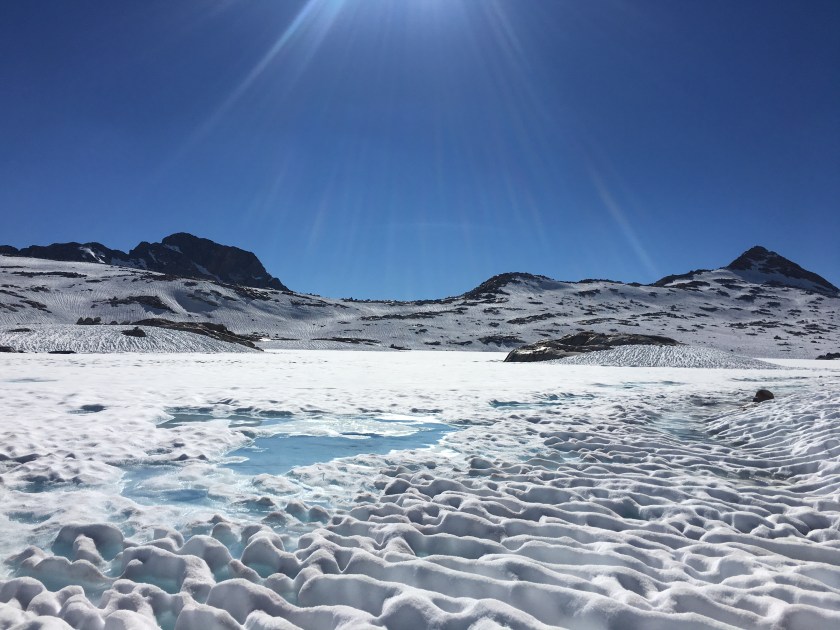
The approach started easy enough as we followed a well-worn boot track across gently sloping snowfields. As we closed in on the pass, I kept looking out for where the trail might pass over the jagged line of mountains in front of us. By the time we arrived at the base of the peaks, with a very solid-looking wall of ice and rock directly ahead and the distant trail appearing more than 300 feet straight above, I was feeling very intimidated. I tried to practice self-arresting with my ice axe, but with the snow covered in uneven bumps from the constant cycle of melting and refreezing, I didn’t have much luck gaining speed in the relatively safe area near the bottom. So I strapped on my nanospikes, grabbed my pack, and started up the ice.

I initially followed a zigzag track upwards, stopping for brief rest breaks in occasional dry patches of broken granite. This method soon exhausted me and I changed tack to follow a shallow path of bootprints straight up the ice wall. This worked ok until I came to a point where the upward track disappeared and another set of boot impressions appeared about six feet off to the left, with only a tiny foothold in between. I would need to awkwardly cross one leg over the other in order to get to the new track, a balancing act in normal conditions and downright dangerous on the side of an ice wall 200 feet above the valley floor. I paused for a minute to calm my nerves, readied my ice axe, and took a couple of quick but steady steps across.

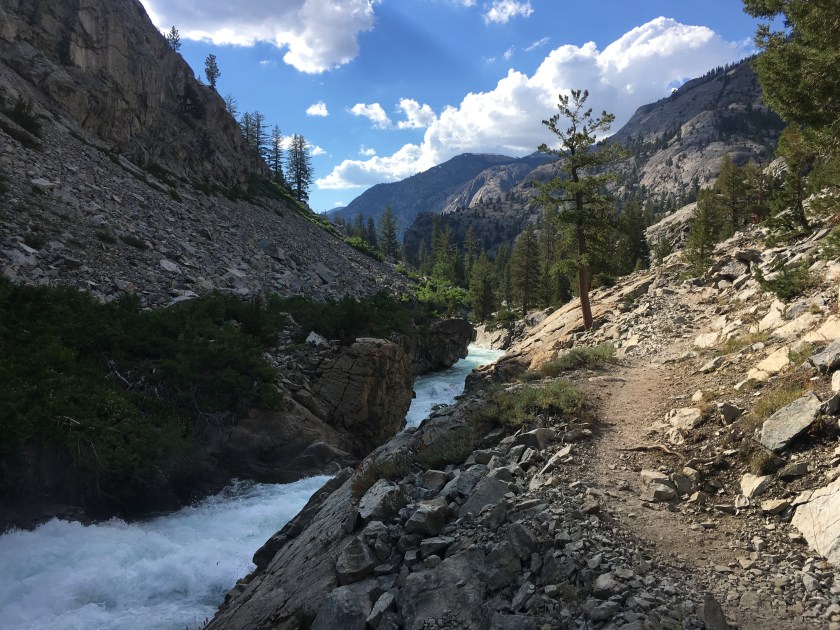
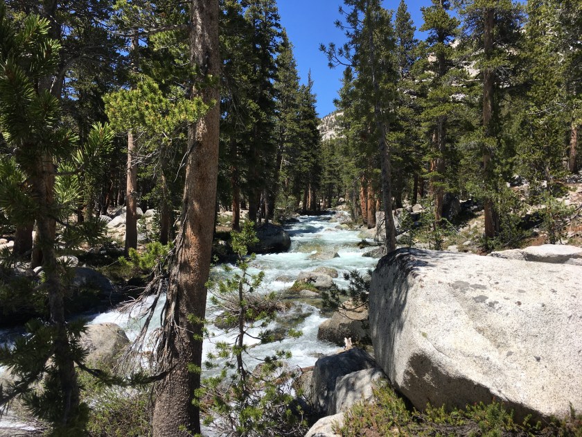
Several switchbacks and a snow chute later, I was at 13,200 feet looking down into the first deep valley of Kings Canyon National Park, my trail home for the next 75 miles.