Day 63: Piped Spring to Wrangle Gap

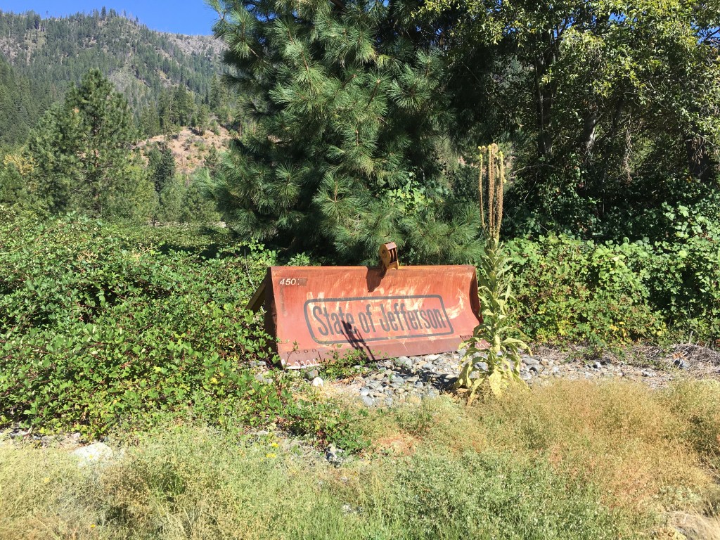
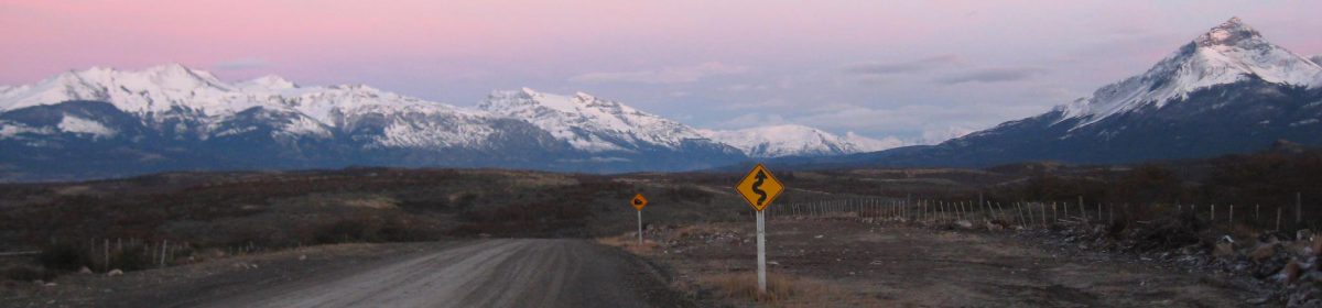
This was it. My final day in California. The Oregon border lay tantalizingly close, and after two months of trekking across the Golden State I was definitely ready for a new state (although the landscape would not change significantly until I reached the volcanoes of central Oregon). In all of my travels I have discovered that walking is the best way to get to know a place and this trip was no different. My journey this far had shown me exactly how big California really is, and I had not even hiked the 650 miles of southern desert! I crossed the border denoted by a signpost and trail register in the warm afternoon, signing my trail name in an excited hand. Less than 1,000 miles to Canada.

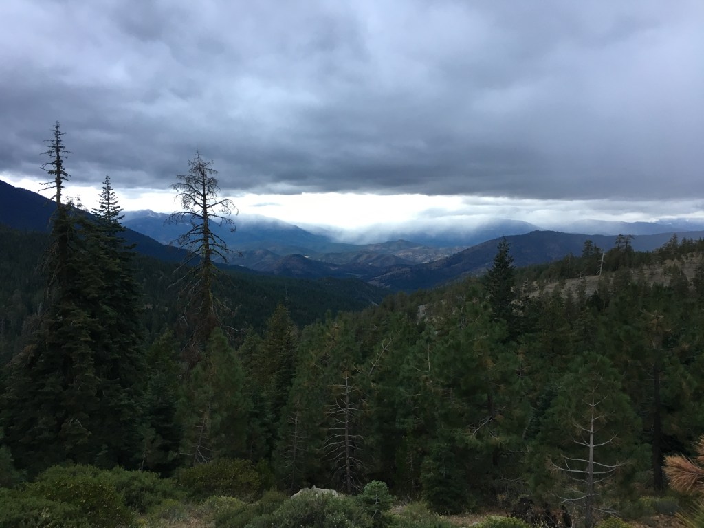
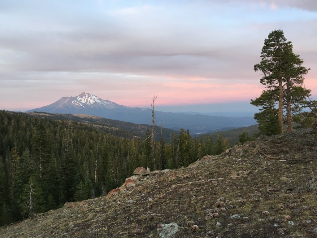
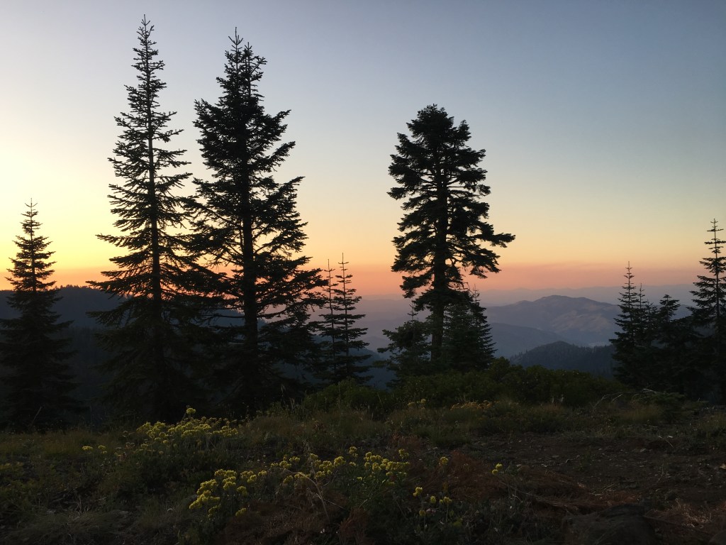
That evening was thankfully the first and only time I experienced wildfire smoke on the PCT. As the sun descended and I began to search for a good spot to pitch my tent I smelled an acrid scent lingering in the air. A light haze covered the rolling hills to the northwest, blurring the red and orange hues of the sunset while I watched night fall from my tent door. I had heard stories of hikers struggling through days of dense smoke and even entire sections of trail closing due to wildfires, and fervently hoped my path north would remain open and clear as I drifted to sleep.

Day 62: Grider Creek Campground to Piped Spring

A six and a half mile walk down a paved road led from the campground to the tiny community of Seiad Valley, the final stop before entering Oregon. The road loops around a large bend in the Klamath River to get to a bridge, so I could see the town long before I entered (it is tempting to ford the shallow river to skip the last three miles of road walking, but this involves illegally cutting through private property). Several dogs barked menacingly at me as I walked past small houses with large “State of Jefferson” signs posted outside. This remote region of northern California has long felt that its interests are not served by the state government in Sacramento. Since the 1940’s there has been an on-and-off movement by some residents to secede from California and (along with a few counties in southern Oregon) form a new state named after Thomas Jefferson. The effort has not led far and whatever its politics, I was welcomed into town with a smile.

It was a brief visit. A big pancake breakfast at the local diner, a quick resupply run at Seiad Valley’s general store (both contained in the same squat building sporting the two Xs of the State of Jefferson flag on its sign) and I was off. Unfortunately I wasn’t fast enough to avoid the searing heat on the steep, exposed climb out of the valley, and had soon gulped down most of my water. Halfway up the mountain a weathered wooden sign atop a rock pile pointed to a tiny trickling spring swarming with yellow jackets. It took what seemed like an eternity to fill my bottles under the low flow and I did my best to remain calm while the insects buzzed alarmingly close to my hand. Luckily they were more interested in the water and allowed me to continue up the rocky, scrub-filled slopes in peace.

Day 60: Etna to Marble Mountain Lookout

Despite the prodigious amount of food I had stuffed in my face the previous afternoon and evening, the hiker hunger was back in full force when I awoke at the hostel in the early morning. I zeroed in on Bob’s Ranch House, a classic diner-style restaurant which I had heard made delicious cinnamon rolls (a personal favorite). Taking a seat at the counter, I was ecstatic when the waitress brought out a gooey hot roll the size of my head. I ordered a full omelette to go with it and ate it all, surprising the waitress with my seemingly bottomless stomach. Once again a small group of locals sitting nearby struck up a conversation and wished me well on my trek, further supporting Etna’s claim to be the friendliest town on the PCT.

The hostel had an arrangement with a local woman who would drive people up to the trailhead for $10, so I duly paid the fee and joined a couple other hikers for the twisting ride up the mountainside. Feeling refreshed and happy after my brief sojourn in town, neither the rocky trail sharply piercing through the thin soles of my trail running shoes nor the intense heat beating down through the burned out forest could dampen my spirits. I soon emerged from the burn zone and hiked past several small lakes to a bluff overlooking the distinctively white (and aptly named) Marble Mountain, where I set up camp amidst the rocks and yellow brush flowers.

Day 59: Saddle to Etna

Eager to get to the trail town of Etna (originally named “Rough and Ready”) in time for a hot lunch, I broke camp at dawn and hiked the 13 miles to the road at a quick pace. My stomach was rumbling by the time I caught up to Vick and Ronan at the trailhead. I had barely caught my breath before a truck drove by and I waved it down for a hitch, yelling goodbye to my friends as I ran after it.

The driver was a retired local firefighter heading back to Etna after visiting family on the other side of the ridge. His toddler grandson sat in the backseat, occasionally adding nonsensical comments to the conversation. He dropped me off in town at the Etna Hiker Hostel, where I booked a bed and enjoyed some care package brownies from a nice sobo couple (short for southbound, meaning hikers who start at the Canadian border and trek down to Mexico).

I made the short walk into the small downtown and got an extremely satisfying smoothie and giant burrito at the local coffeehouse, before proceeding to what appeared to be the local tavern for a drink. Once inside I felt like I had been instantly transported to a fancy cocktail bar in San Francisco, complete with house-distilled gin tasting room and a gourmet menu. Feeling very out of place with my ragged hiking clothes and unkempt facial hair, I was nonetheless welcomed by the friendly staff. I sampled a flight of the various types of gin which quickly made my head swim. I then ordered two large plates of food, eventually shambling back to the hostel full and content.

Day 58: Scott Mountain Campground to Saddle

When I awoke in the morning the floor of my tent was covered in rainwater. The clouds continued to spit mist as we started to hike, but soon gave way to the strong California sun. After crossing over the location of an old stage road and way station from the 1860s we entered the Trinity Alps Wilderness. I had long wanted to visit the Trinity Alps after hearing friends in the Bay Area praise its remote beauty. It did not disappoint, and the dark sharp line of peaks in the distance soon had me in a rapturous trance. Pretty little streams danced down the mountainside and across the trail to flow into the pristine alpine lakes below. The feelings of pain and toil that sometimes dominate the trail experience vanished, and I walked on with a big smile on my face.

During our lunch break on a rocky ridge I laid my tent and sleeping pad out in the sun which quickly dried the light fabric. The PCT only cuts through a tiny corner of the Trinity Alps, but I knew it would draw me back one day. Vick and Ronan were rushing to get to Seiad Valley near the Oregon border but decided to camp with me one final night, and we found a wonderful open spot on a forested ridge with Mount Shasta peaking through the trees to the east. We celebrated a last gourmet dinner of (you guessed it) ramen and instant potatoes while day faded into the starry night.

Day 57: Shasta Viewpoint to Scott Mountain Campground

I awoke to watch the sun rise behind Mount Shasta through the door of my tent, still wrapped in my sleeping bag against the cold mountain air. Soon after I began my hike for the day I was surprised to see Vick nonchalantly sitting on a rock on the side of the trail. Instead of being ahead of me as I had thought, he and Ronan had actually been following behind me for the entire previous day, trying to catch up with me while I was (mistakenly, as it turned out) rushing to try to catch them! I was glad to see him again, and when Ronan appeared a few minutes later we happily set off again together toward the north.

In the mid-afternoon we ran into a hiker that Vick and Ronan knew from their time in the desert section. He had skipped ahead by car from Kennedy Meadows back in June to avoid the snow in the Sierras, and was now heading back south to complete the sections he had missed. Flip flopping, as this practice is known among thru-hikers, was very common in 2019 due to the very high snow levels that year (although it is technically not allowed by the rules of the PCT permit, especially in the popular High Sierra). Some day hikers had given him a giant bag of peanut butter M&Ms and he graciously shared them with us while we chatted.

It began to sprinkle rain as we descended toward the remote Highway 3 in the Trinity Mountains. An eerily deserted campground lay just off the road, and we had our choice of sites to set up for the night. The rain fell harder as we cooked dinner at a picnic table under a fir tree. I soon crawled into my tent to escape the deluge, but unfortunately my tent’s design had a major flaw which led water to seep in near the head. Exhausted from the day’s hike I quickly fell asleep anyway, too tired to worry about the wetness until the morning.

Day 56: Indian Springs Stream to Shasta Viewpoint

After their disappearance the previous night, I had guessed that Vick and Ronan might have camped at the next water source up the trail. But there was no sign of them at the rushing stream around the bend, nor did they appear at the next creek, or the next. With no way to contact them, there was nothing to do but hike on alone. The prospect saddened me, as I had gotten used to enjoying the jovial spirit and light-hearted conversation of my new friends. It is very easy to lose a hiking buddy on the trail (one wrong turn at the wrong time and they’re gone), but it would not be the last I saw of Vick and Ronan.

I climbed up in the cool shade of morning past the Castle Crags, a jagged granite rock formation jutting out of the surrounding forest. The weather was hot and water scarce. To fill my bottles I had to trek a third of a mile off-trail to scoop from a stagnant-looking pool ironically named “Heavens Spring”. As I walked along the ridgeline, majestic views of Mount Shasta helped my mollify my melancholy at losing Vick and Ronan. Dusk approached and I found the perfect tentsite to watch the sunset paint the volcanic peak in deep shades of pink and purple, filling my heart with a sense of peace.

Day 55: Dunsmuir to Indian Springs Stream

“It’s the vortex,” Vick told me. “Just another 15 minutes.” We were sitting in the Crossroads Hiker Hostel in the late afternoon, listening and singing along to records as Ronan played his ukulele on the couch. I checked the time on my phone, becoming increasingly anxious to get back on the trail before the sun went down. But the vortex (the inertia to stay in town and enjoy the fruits of civilization) had sucked my hiking buddies in, and there was no leaving until they were satisfied.

After a big and welcome breakfast, Kelly had given us and a few other hikers a ride into town to resupply. The Dollar General was well-stocked, and in addition to backpacking food we each bought a quart of ice cream to scarf down in the parking lot outside. Back at the hostel we ran into Bubblewrap and Pioneer, the perfect excuse to hang around the large backyard drinking beer.

I eventually coaxed Vick and Ronan into leaving, and after getting dropped off at the trailhead they continued on singing as we hiked. In fact they were so distracted by belting out classic tunes that they took a wrong turn. I was some distance behind them and (being in a more sober mind) followed the correct path, but when I arrived at our planned campsite there was no sign of my friends. It was getting dark and my muscles burned from the previous day’s death march, so I decided to cook a pouch of instant potatoes and find them in the morning.

Day 54: Gold Creek Junction to Dunsmuir

Bright moonlight was still shining through the mesh ceiling of my tent when I awoke and began to break camp. Vick and Ronan wanted to get into town today, and they somehow convinced me to wake up at 2am to attempt the 40-mile trek to where the trail crosses Interstate 5 near Dunsmuir. I had not yet done any night hiking and was curious to see how I would enjoy it. There was no time to waste so I stuffed a Cliff bar in my mouth, shoved my supplies into my pack and we were off.

For the first couple of miles we hiked along an open ridge under the moon and stars, but the trail soon delved into a narrow creek canyon, forcing us to use our headlamps. There is something very isolating about night hiking, and sounds of animals or creaking trees take on a threatening tone. I lost much of my sense of time and place in the darkness and each bend in the trail felt much like the last. After ten miles we finally reached the end of a long winding descent to the McCloud River, where in the grey light of dawn we took a long break to eat and rest our legs a bit for the long day ahead.

As the day wore on and we notched up mile after mile, the pain in my legs became greater and greater and the skin of my thighs and lower back turned raw from chafing. We took another long and welcome respite at Squaw Valley Creek, jumping off the rocky canyon walls into the cold clear water to escape the hot afternoon sun (which Vick and Ronan did from a dangerous height). By mile 33 we were all hurting and exhausted, and decided to cut off about four miles of trail by taking a shortcut on an old logging road. As we entered the final leg at Castle Crags State Park I sang 80s songs to keep my feet moving. I knew if I stopped walking I wouldn’t be able to start again.

We stumbled to the road aching and hungry and immediately called Kellyfish, the owner of the Crossroads Hiker Hostel, who graciously picked us up. We ordered three extra-large pizzas and finished it all before enjoying a soak in Kelly’s hot tub. My body felt completely worn but I was somewhat amazed that I successfully finished the day, and I soon passed out on a mattress set up in the yard for some well-deserved sleep.

Day 53: Screwdriver Creek to Gold Creek Junction

While trudging under the beating sun on Hat Creek Rim I got my first look at 14,000 foot Mount Shasta peeking its snowy head above the northern horizon. Today (and for the next two weeks) the mountain would dominate the skyline as the trail made a large circle around it on the way to Oregon. After Lassen, Shasta is the next volcano in the Cascade Range, a sign that I had finally left the Sierras and was heading into unfamiliar territory.

I hiked all day with Vick and Ronan through low pine forests and dense scrubland, often crossing one of the many dirt roads which wind their way among the northern California hills. We camped at a remote road junction leading down to a small creek, and as I labored to set up my tent on the rocky ground I felt jealous of Vick’s comfortable-looking hammock hanging in the nearby trees. We cooked our separate meals (I had a simple but effective bowl of ramen) and ate together, telling jokes and stories as the day’s light waned and stars filled the sky.