Day 76: Sisters to Santiam Pass Burn Zone

Planning to get an early start in order to meet up with my friend Jason near Mount Hood, I scarfed down a quick continental breakfast at the motel and walked to the highway junction to try to hitch a ride back to the trail. I stuck my thumb out and several cars passed, but none of them stopped or even slowed down for the scruffy-looking hiker on the side of the road. I called some numbers that had been posted in the motel lobby advertising rides for PCT hikers, to no avail. An older man walked past and told me about a group of trail angels at a local church who help out hikers. After an hour or so of waiting and becoming increasingly frustrated, I decided to take the man’s advice and walk the mile down the highway to try my luck at the church. Thankfully one of the trail angels happened to be there for a knitting group session, and after a few minutes we were in her SUV on the road up to Mackenzie Pass, to my great relief.

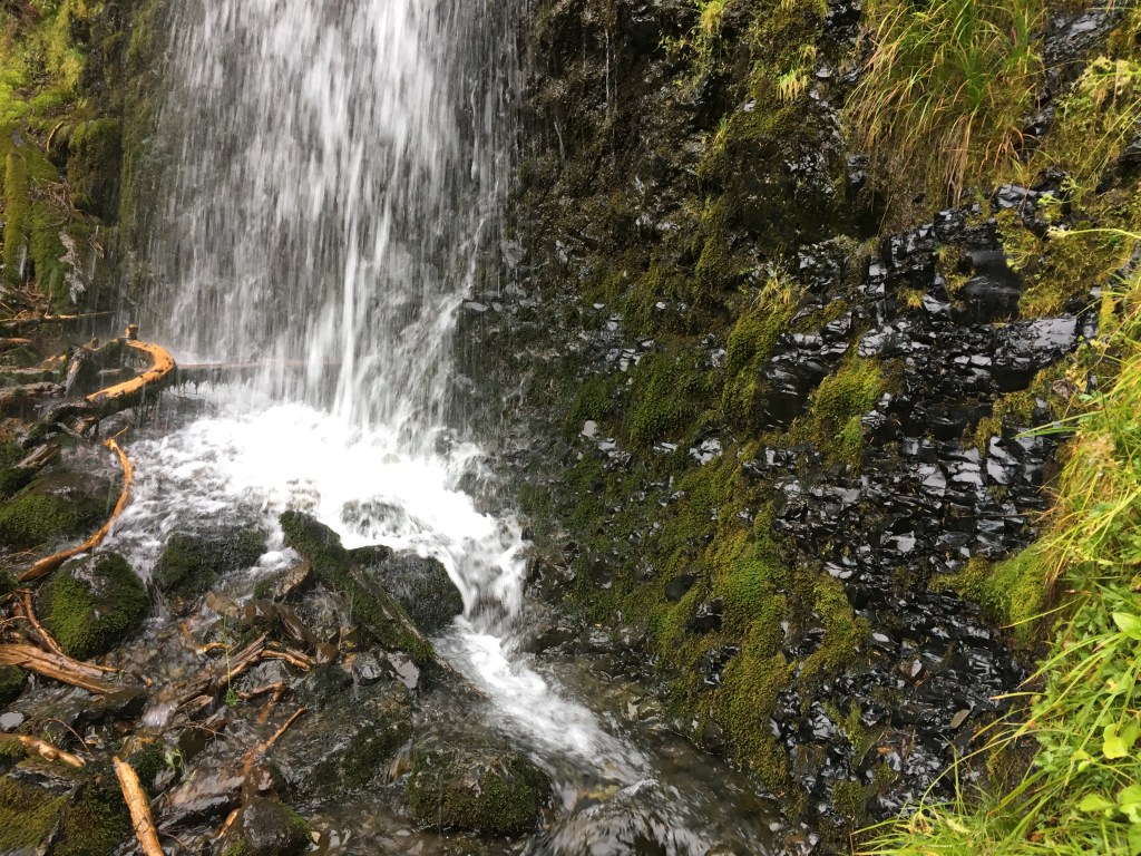
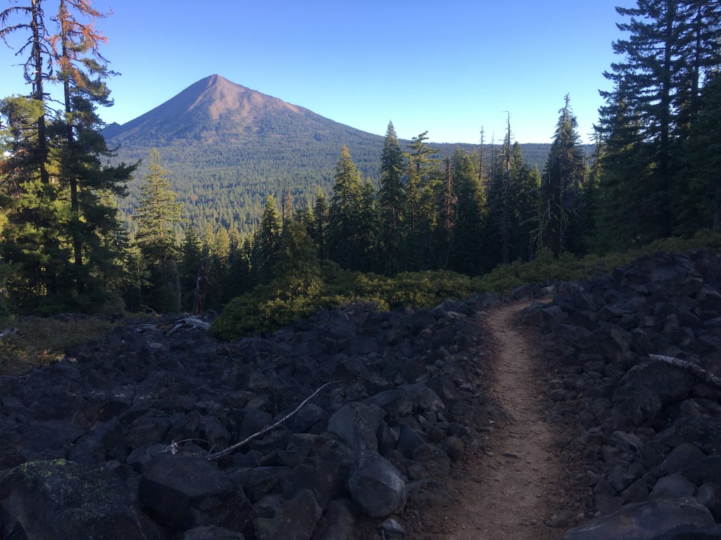
A bike race was going on over the highway and hundreds of cyclists and support people crowded the top of the pass. I took a quick peek at the view from the nearby observatory, scouting the path ahead. Two long miles of lava rocks awaited me, and once again I wished I had real hiking boots to protect my feet from their sharp cutting edges. After carefully making my way through the lava field I barely had time to catch my breath before the sky opened up. In just a few minutes all of the gear I had carefully dried out in Sisters got completely soaked. The small umbrella I had carried all the way from Lake Tahoe did little to help against the deluge. I trudged onward, my shoes increasingly covered in mud while the rain ran down the trail in little rivers.

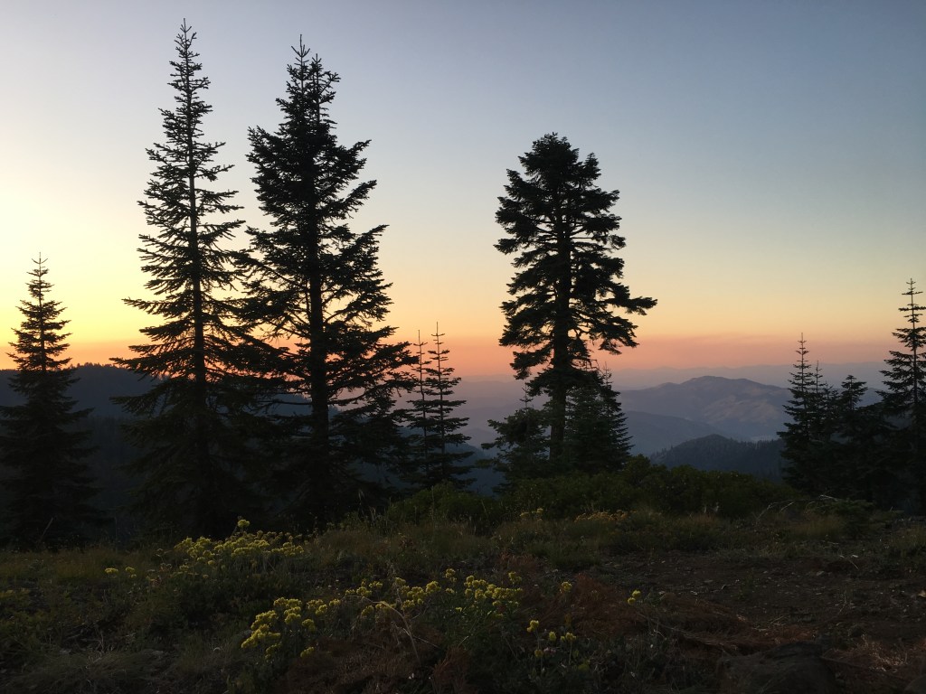
When I came to the turn off toward Big Lake Youth Camp I immediately took it, hoping to find some shelter from the unceasing downpour. The camp was closed for the season but to my eternal gratitude the hosts had left a cabin open for PCT hikers to use. I ran inside and was greeted by a dozen other thru-hikers taking shelter from the rain. Most were planning to sleep there; alas I had a timeline to keep so I ate a quick meal, enjoyed some hot tea and hit the trail again as soon as the weather let up. I crossed another highway at Santiam Pass and entered a gloomy burn zone where I made a hasty camp, wisps of fog drifting eerily among the dead and blackened trees.

Day 75: Reese Lake to Sisters

The day dawned dark and gloomy, with a thick band of clouds sitting on the mountains. Radek set off before daybreak and I followed once the pale grey light grew bright enough to see by. I soon entered the Obsidian Limited Entry Area, a specially protected resource area within the Three Sisters Wilderness. Large deposits of the shiny black rock bordering the trail helped me understand why this area required a special permit to enter. I then came upon a waterfall flowing over a short cliff made entirely of obsidian. I stood there watching the cascade for a long time, awestruck by the simple beauty of water and rock.

Following the magical creek upstream I passed a couple of small lakes shrouded in ghostly fog. What had been a serene, enjoyable morning swiftly took a downward turn as the wind began to pick up and it became very cold. Mist soaked my light jacket and by the time I caught up with Radek at South Matthieu Lake I was shivering and miserable. An increasingly heavy rain made my attempt to shelter beneath some stunted trees utterly futile. The lunch I had been looking forward to became an exercise in pain as I bumbled around my pack with frozen fingers, clumsily putting a tortilla sandwich together and blowing on my hands in a vain effort to warm them.

I had planned to continue hiking with Radek to Ollalie Lake where we would rent a cabin and celebrate my birthday, but the intense cold and wet overwhelmed my sense of anticipation and I decided to head to the town of Sisters to dry out when we reached the highway at Mackenzie Pass that afternoon. The path down to the highway led through a field of sharp lava rocks, adding to my torment. I caught a ride into town in a Jeep with a man and his dog and met another hiker at the Sisters Inn to split a room. After buying myself a birthday dinner and giant margarita at a Mexican restaurant I passed out on top of the motel bedspread, exhausted but warm.

Day 74: Desane Lake to Reese Lake

The day began pleasantly enough, with the trail winding gently past a string of shimmering lakes. Radek had caught up to me the evening before (I passed him unknowingly when he stopped at an off-trail cabin) and we took a long snack break at Dumbbell Lake, where a narrow, forested peninsula jutted out into the tranquil water. After bypassing the turnoff to Elk Lake Resort I climbed Red Hill, admiring the views of Mount Bachelor and the first of the rugged Three Sisters peaks to the north.

By the time we reached Sisters Mirror Lake the weather had started to turn. Still, I took the opportunity to jump into the glassy water. The cold was bracing but I felt refreshed as we ate lunch on the lake shore, watching the clouds gather over the trail ahead. I had heard that this section of the PCT was especially scenic but the landscape we walked into felt disconcertingly eerie. Ghostly low clouds moved silently among the blasted volcanic rocks and small copses of stunted trees. The brisk wind cut through my thin jacket as I followed Radek to a small pond where several other groups of hikers had set up camp. We found an open spot behind some trees and had dinner. Radek had brought some powdered hot chocolate, and drinking the warm, sweet liquid greatly lifted my dampened spirits. It is amazing how things as simple as a hot beverage can completely transform the trail experience.

Day 73: Rosary Lakes to Desane Lake

Mist rose from the surface of the lakes in a ghostly cloud as I broke down my tent in the pale dawn. Radek and I departed the campsite together but his longer strides quickly sped him ahead and out of my sight. The thick layer of fog that had settled into the low valleys overnight burned off slowly beneath the rising sun, leaving a cornucopia of tiny lakes dotting the landscape. Hoping to catch Radek for lunch, I stepped off the trail at the larger Charlton Lake but he was nowhere to be seen. With my tent laid out to dry in the sun, I slowly ate my tortillas and cheese on a rock outcrop by the shore, the peaceful silence only broken by someone’s dog splashing around in the water.

Disappointed to have lost Radek, I continued on with the thought of finding him at camp in the evening. The trail wound through dense forest and between innumerable ponds brimming with plant life. My mood brightened dramatically when I discovered a patch of huckleberries next to the path, and I stopped to taste some of the juicy dark purple fruits. Berry bushes lined the trail for the next several miles. My pace slowed considerably as I stopped every few feet to pick and eat more of them, filling my bottomless hiker stomach with nature’s bounty.

Day 72: Oregon Skyline Trail to Rosary Lakes

The thunderstorm which had roared in my dreams through the night cleared by the morning, or so I thought. As I walked by the crystal clear Diamond View Lake on my way back to the main PCT, the bright morning sun began to disappear again behind darkening grey clouds. Fearing being caught out in the open by another storm, I aimed my feet toward Shelter Cove, a small resort nestled against the shores of Odell Lake. I wasn’t quite fast enough, however, and the skies opened up in a bone-drenching downpour. Following the trail along a creek swollen with rainwater, I eventually reached the paved road leading to the resort.

Shelter Cove certainly lived up to its name. As soon as I arrived I ducked under the giant tent the managers had graciously set up for PCT hikers, finding a treasure trove of discarded ramen packets and half-empty peanut butter jars. When the heavy rain started to subside I made my way over to the small cafe where I enthusiastically ordered a burger and beer to warm my stomach. My friend Radek, who had taken the official route, then appeared and we decided to hike out together once the storm finally broke.

We found a beautiful campsite on a small wooded isthmus between two lakes. It had hailed during the thunderstorm but the tiny balls of ice quickly melted. I set up my tent on a dry patch of pine needles. The rain returned as Radek and I ate dinner. We didn’t linger and I was soon warm and dry in my down sleeping bag. Unfortunately the delicious burger I had so enjoyed at Shelter Cove did not agree with my stomach, and I was forced to abandon my little sanctuary to go dig a cathole. Doubly unlucky was my location directly in between two lakes, which meant I had to trek a fair distance up a hill in the dark and wet to get far enough to avoid contaminating the water. For the second time that day I wasn’t quite fast enough, and what had been a cozy if damp evening turned into an uncomfortable and messy night. Good thing I brought that extra pair of underwear.

Day 70: Mazama Village to Mount Thielsen

There are many different philosophies to hiking the Pacific Crest Trail. Some approach the experience casually, jumping around to different sections depending on weather, timing or simply their own whims. Others attempt to trace a line of continuous footsteps from Mexico to Canada, focused on walking the full distance. And some hikers are purists, not deviating from the official PCT for anything unless forced by a trail closure (and even then a few will try hiking through despite the danger of rockfalls or fire damage).

In Crater Lake National Park, those sticking to the main trail will miss the spectacular views offered by the alternate route along the lake’s rim. I was no purist (if you couldn’t tell already) but I did want to hike in continuous footsteps during my PCT journey. Leaving the campground at Mazama early, I trekked up to the crater rim and looked down into the deepest lake in the United States. The brilliant blue water contrasted starkly with the surrounding arid landscape and light blue sky. I strolled along the western edge, taking my time to enjoy the striking scenery.

After a few miles I reluctantly left the lake behind and plunged into a long, flat stretch through a seemingly neverending forest. At the end I crossed a highway where I found my friend Radek sitting on a log surrounded by 20 or 30 five-gallon jugs of water. Wanting to experience the entire length of the official PCT, Radek had hiked the main route and asked me about the alternate along the crater rim. I showed him some photos and he shook his head, immediately regretting his decision to trek through the hot and uninteresting burn zone that made up the “official” trail. I respected his dedication, however, and noted that Crater Lake would still be there for his next visit: “You always have to leave something to come back to.”

Day 69: High Saddle to Mazama Village

The arcing hike into Crater Lake National Park was hot, dry and largely burned out, but led to a large pot of trail magic at the end. Forced to carry a full three liters of water to make the 20 mile stretch to the park entrance, I doggedly trudged along through a blackened forest, the tall husks of long-dead trees towering overhead but offering little shade. At times the high volcanic peak of Mount Thielsen reared its head above the horizon, and an unknown snow-capped mountain could be seen at one point in the far distance.

I felt relieved when finally I reached the low wooden sign demarcating the border of the park. A short walk down the road led to Mazama Village, the main visitor area complete with campground, small store and most importantly, a restaurant to which I immediately beelined. Extremely thirsty, I gulped down a full 20 ounce soda and refilled my cup twice before my large pizza arrived. While gracelessly shoving whole slices of gooey cheese into my mouth at a table outside, a man sitting a few tables down approached and asked if I was hiking the PCT. I told him about my journey and learned his name was Roger and he was on a roadtrip with his wife. When I finished eating he generously offered to donate some supplies for my trip, including two dehydrated Mountain House meals and a tall Coors beer. I thanked him profusely and we parted ways, wishing one another well as I walked toward the designated thru-hiker campsite reflecting on the kindness of strangers.

Day 68: Lava Rocks to High Saddle

I had camped in a small valley between two long stretches of sharp volcanic rock. If there were one kind of terrain where I wish I had solid hiking boots rather than my light trail runners, this was it. Thankfully the trail was well-maintained and my feet didn’t hurt too badly as I shambled toward the rising cone of Mount McLaughlin in the distance.

Turning off of the main trail just before Highway 140, I took a short mile and a half detour to the Fish Lake Resort. Trekking across the lava rocks had piqued my appetite, and I sat down at a wooden table outside the resort restaurant ready to dig in to a gigantic tri-tip skillet. I washed down my breakfast with a cup of hot coffee while watching a fisherman toss a line out into the eponymously named lake. Feeling quite satisfied, I grabbed a couple of extra jelly packets for future peanut butter & jelly tortillas and quickly got back on the trail. Glimpses of the large Upper Klamath Lake peeked out beyond the hills to the east as I walked.

Day 66: I-5 to Hyatt Reservoir

I left Ashland in an Uber, traveling south back to the PCT trailhead just off the interstate. My friend Jason (trail name Left Foot) had told me about a lesser known alternate route leading to the Green Springs Inn, where he had eaten “the best burger on the trail”. Despite having just spent a day stuffing my face with french toast and burritos, I couldn’t resist the lure of seeking out this fabled burger (the promise of a free root beer float didn’t hurt either).

Unfortunately the location of the Inn was not included on my GPS map. Following some vague written directions Jason had pointed me to, I turned off the main PCT onto an overgrown track which lead downhill past the rusty shell of an abandoned car to a reservoir. Small purple bunches of Oregon grape lined the path. I picked a couple of the edible berries and put them in my mouth. The juice that exploded onto my tongue was almost too tart to bear, and I quickly drank some water to wash the sour fruit down.

I then crossed a dam, walking past a disconcerting “No Trespassing” sign before starting off on a scrubby dirt road next to a small aqueduct. The directions instructed me to cross the aqueduct on a concrete slab when I reached a cairn, but as I continued to walk and walk and passed concrete slab after concrete slab I began to grow concerned. I had the sneaking suspicion that I had missed the turn-off and gone too far. I knew there was a road to the north where the Inn was supposed to be, and so trusting my instincts (and to luck) I took the next little bridge over the slow moving water and proceeded to bushwhack through the forest. Soon a row of wooden cabins appeared ahead, and walking parallel to the buildings I reached the grassy backyard of the Inn. Covered in sweat and extremely relieved to have found my destination, I walked inside and ordered a gigantic burger. In that moment it was indeed the best burger I had eaten on the PCT.

Day 63: Piped Spring to Wrangle Gap

This was it. My final day in California. The Oregon border lay tantalizingly close, and after two months of trekking across the Golden State I was definitely ready for a new state (although the landscape would not change significantly until I reached the volcanoes of central Oregon). In all of my travels I have discovered that walking is the best way to get to know a place and this trip was no different. My journey this far had shown me exactly how big California really is, and I had not even hiked the 650 miles of southern desert! I crossed the border denoted by a signpost and trail register in the warm afternoon, signing my trail name in an excited hand. Less than 1,000 miles to Canada.

That evening was thankfully the first and only time I experienced wildfire smoke on the PCT. As the sun descended and I began to search for a good spot to pitch my tent I smelled an acrid scent lingering in the air. A light haze covered the rolling hills to the northwest, blurring the red and orange hues of the sunset while I watched night fall from my tent door. I had heard stories of hikers struggling through days of dense smoke and even entire sections of trail closing due to wildfires, and fervently hoped my path north would remain open and clear as I drifted to sleep.